
We’re back from what proved to be an utterly awesome road trip/workcation over the last 10 days. We left mid-day on Friday with the intent of dispersed camping just outside the Wawona (South) gate at Yosemite National Park. This would give us the perfect jumping off point on Saturday morning to checkout the sequoias at Mariposa Grove before heading up to Yosemite Valley to take in the wonders. The drive from LA up the West side of the Sierras is uneventful (if not kinda boring). We’d originally aimed to dug into Sequoia National Forest on the way up and see some things there, but Highway 99 doesn’t exactly cut close to the Sierras, so we ultimately passed on that idea.
We made good time…right up until we turned onto highway 41 to head toward Yosemite. I’d noticed the smoke cloud rising, but having checked the weather and the route at about noon on Thursday, I didn’t think much about encountering any issues. Then we saw the sign…
Yosemite South entrance: closed due to Washburn Fire.
Womp womp (cue sad trombone). We immediately pulled over — at this point it was nearly 5pm — to figure out the situation. Low and behold, the Washburn Fire started the evening before right smack in the middle of Mariposa Grove. So much for that idea. After ten minutes of mildly frantic app hopping, we managed to book a campsite at the Hensley Lake Recreation area about 40 minutes away. Not exactly anything spectacular, we arrived to the sensation of standing in front of a giant hand dryer. But it would do.

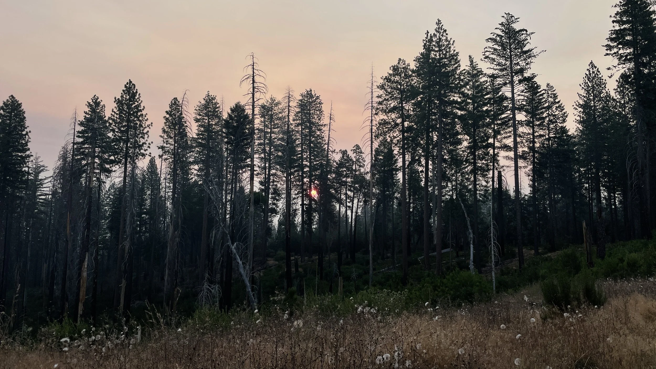
After it finally cooled down enough for us to crash, we awoke to check on the progress of the Washburn Fire. Between Friday evening and Saturday morning, it had roughly doubled in size with 0% containment. The view toward Yosemite presented us with a smoke plume that looked reminiscent of an atomic bomb and extended northward over the park.
With some trepidation, we packed up the basecamp rig and headed toward Yosemite Valley to see what the day would bring. The drive from Hensley Lake Recreation Area to Yosemite National park is utterly gorgeous. Tiny backroads through the Sierra foothills keep you off major highways, winding your way through lands that look like they popped out of an old Western movie. As we got closer to the park, we saw plenty of cars heading in the opposite direction, but few progressing toward the park. We had every expectation that we might find the park entirely closed due to the Washburn Fire by the time we arrived.

We pulled up to the West Entrance just past El Portal around 10am where we encountered a roughly 30-minute wait at the entry gate. A number of folks turned around rather than waiting it out, but with peak-hours reservation in hand, we waited patiently until it was our turn to head into the Valley.
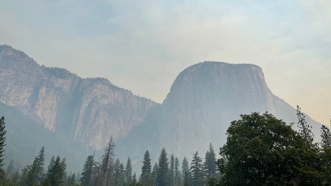
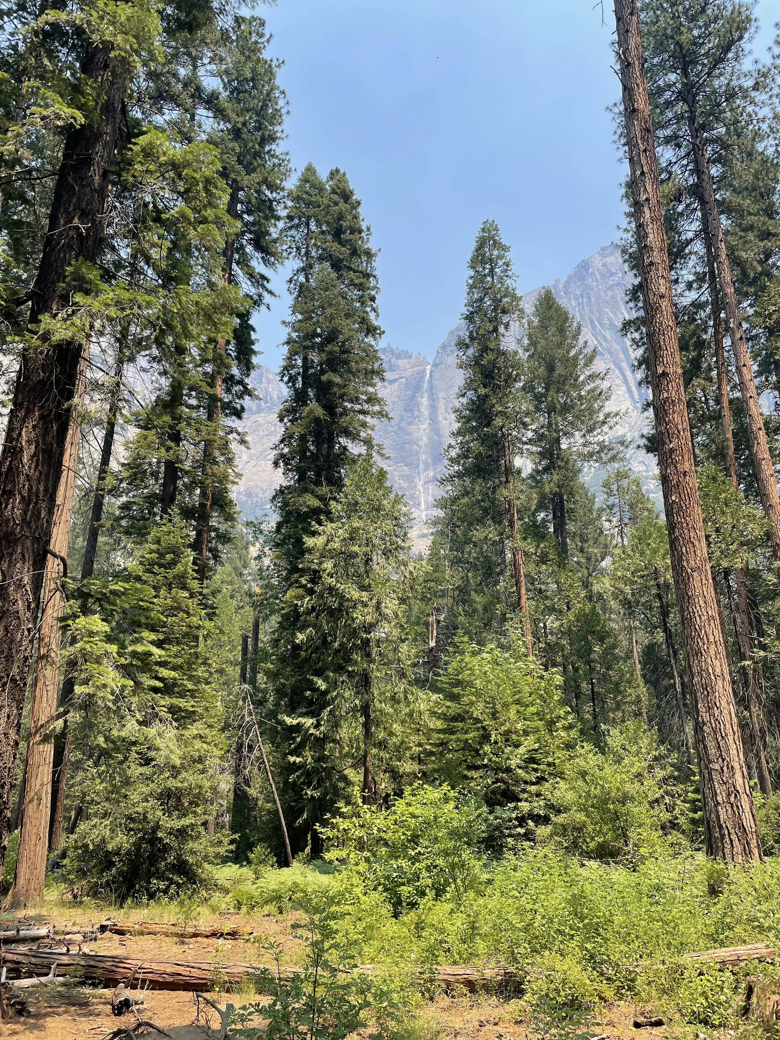
To say there’s nothing like the drive into Yosemite Valley would be an understatement. Before you even get much sense of the immense, towering wall surround the narrow space, you encounter lush forests around the Merced River making for a beautiful drive. Then, suddenly, the Valley opens up and reveals itself with views of Bridal Veil Falls and El Capitan.
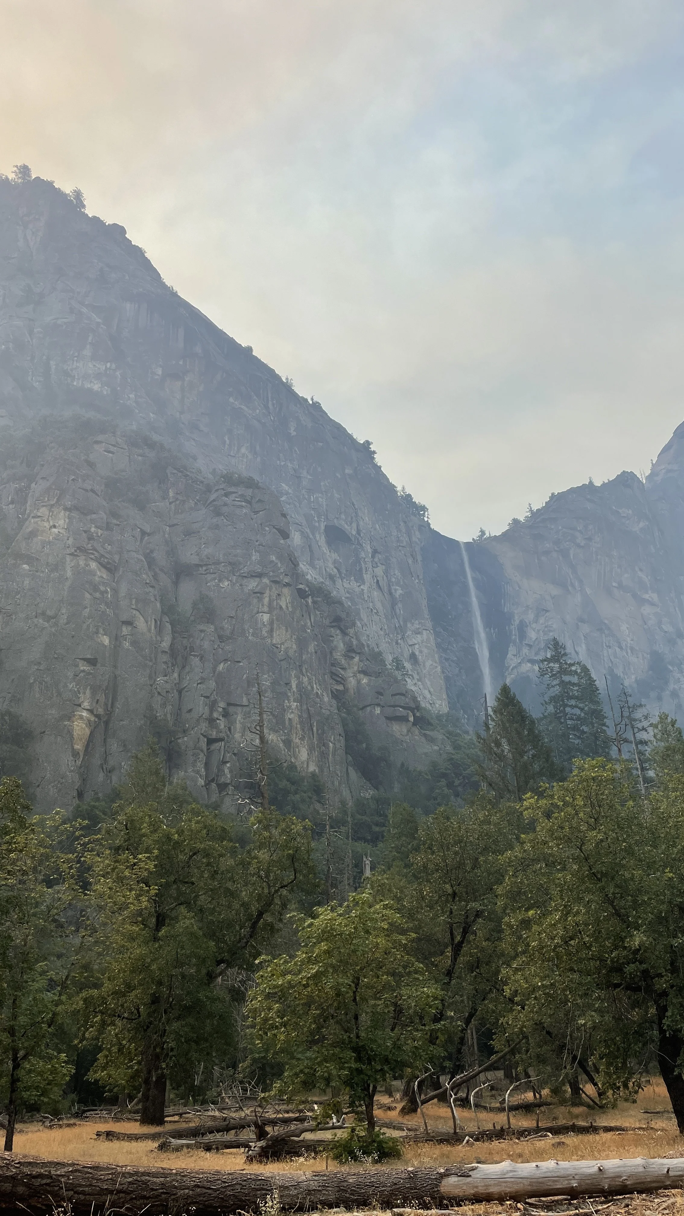
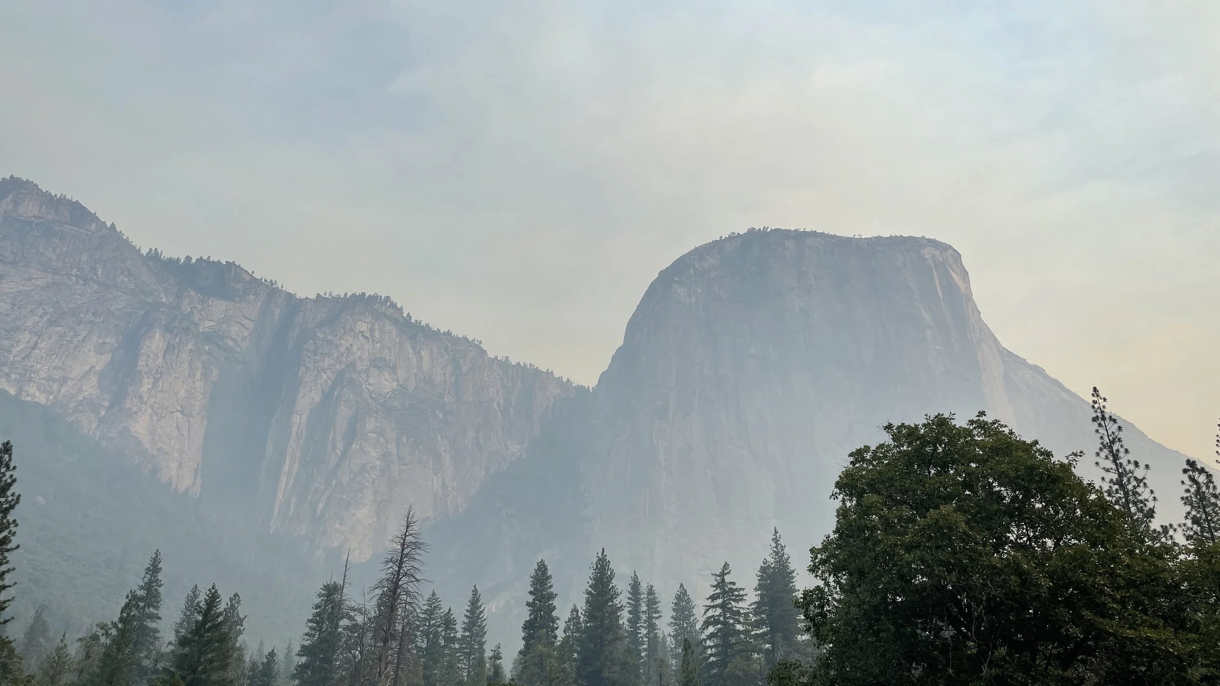
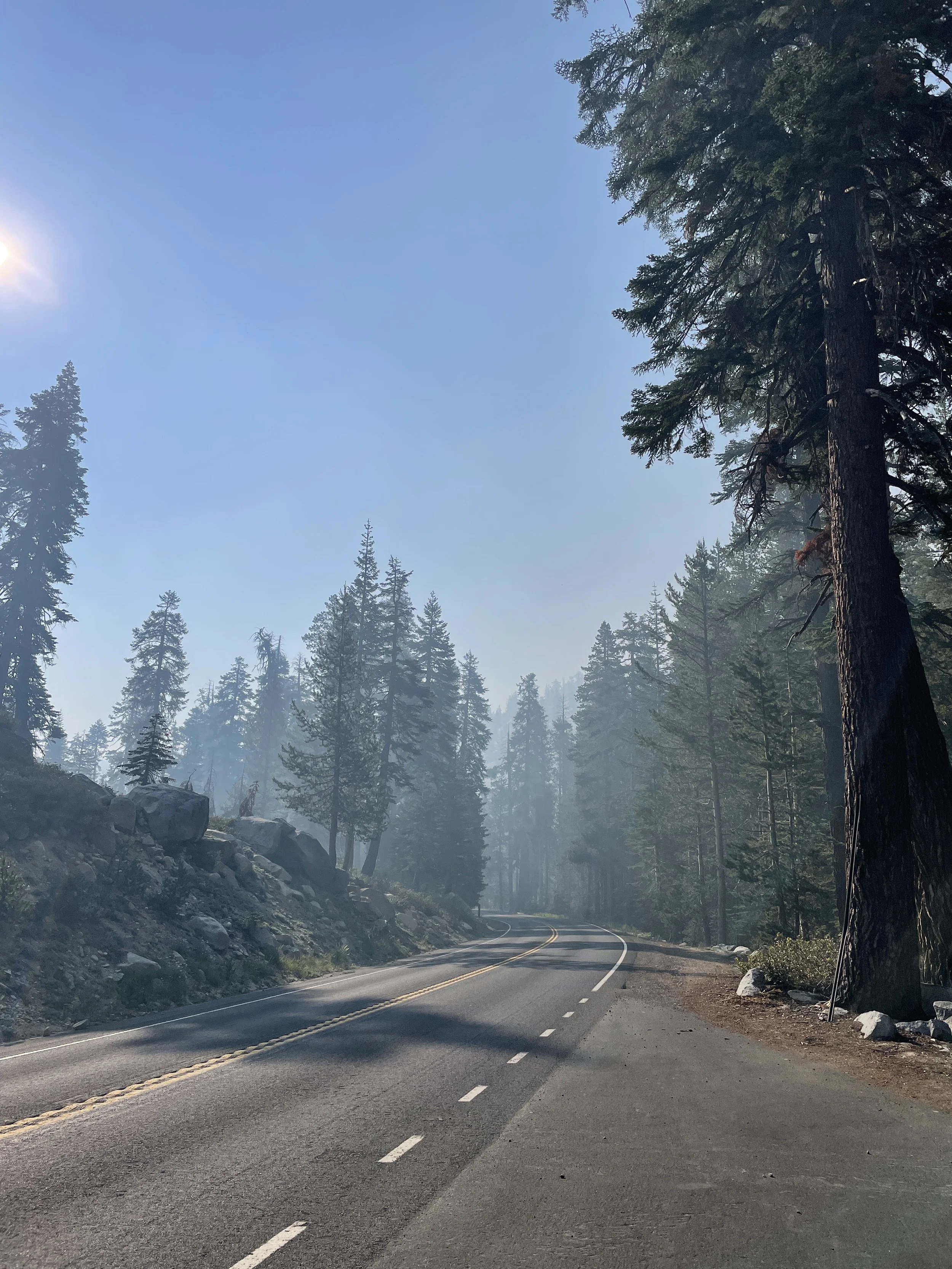
Smoke from the fire a few miles south bathed the valley in an eerie, soft light. Both unique & picturesque as well as a stark reminder of the devastation happening at the Southern end of the Park. We wove our way deeper into the Valley, finally parking at the lot across the street from the well-known Camp 4 so that we could wander afoot.
With our pup in tow, our choices of activities within Yosemite National Park were somewhat limited. Dogs aren’t allowed on any unpaved trails (or on the free shuttles that most folks use to traverse the Valley) which severely limits options. With that in mind, we wandered along the hike and bike path to the Lower Yosemite Falls trail to take in the views.

After exhausting the canine menace (who was still recovering from recent surgery, so it didn’t take much), we drove around the Valley and made a few more random stops throughout the afternoon. Finally the heat and lack of firm plans for a campsite did us in and we headed Northwest to find a campsite for the night.
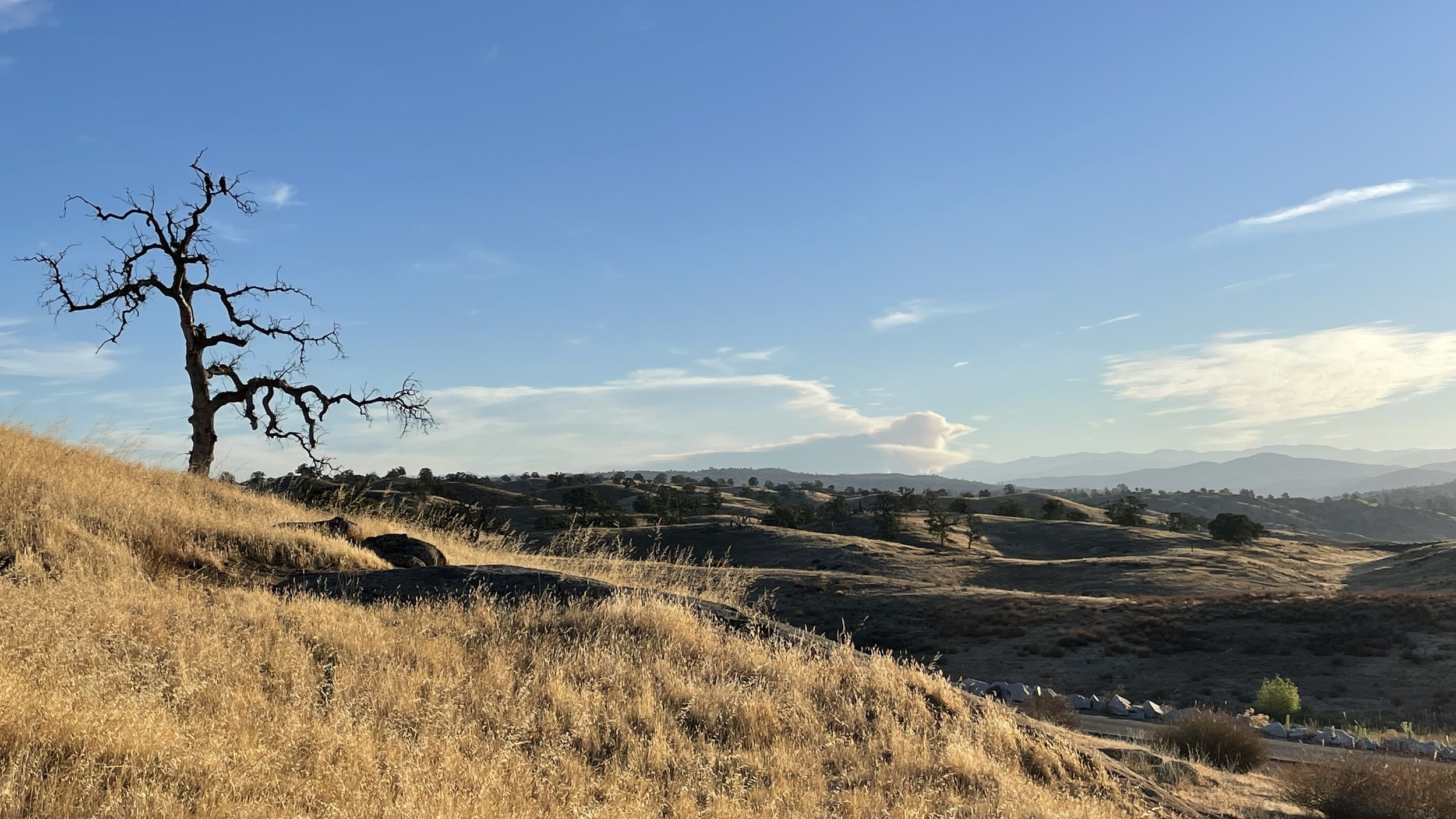
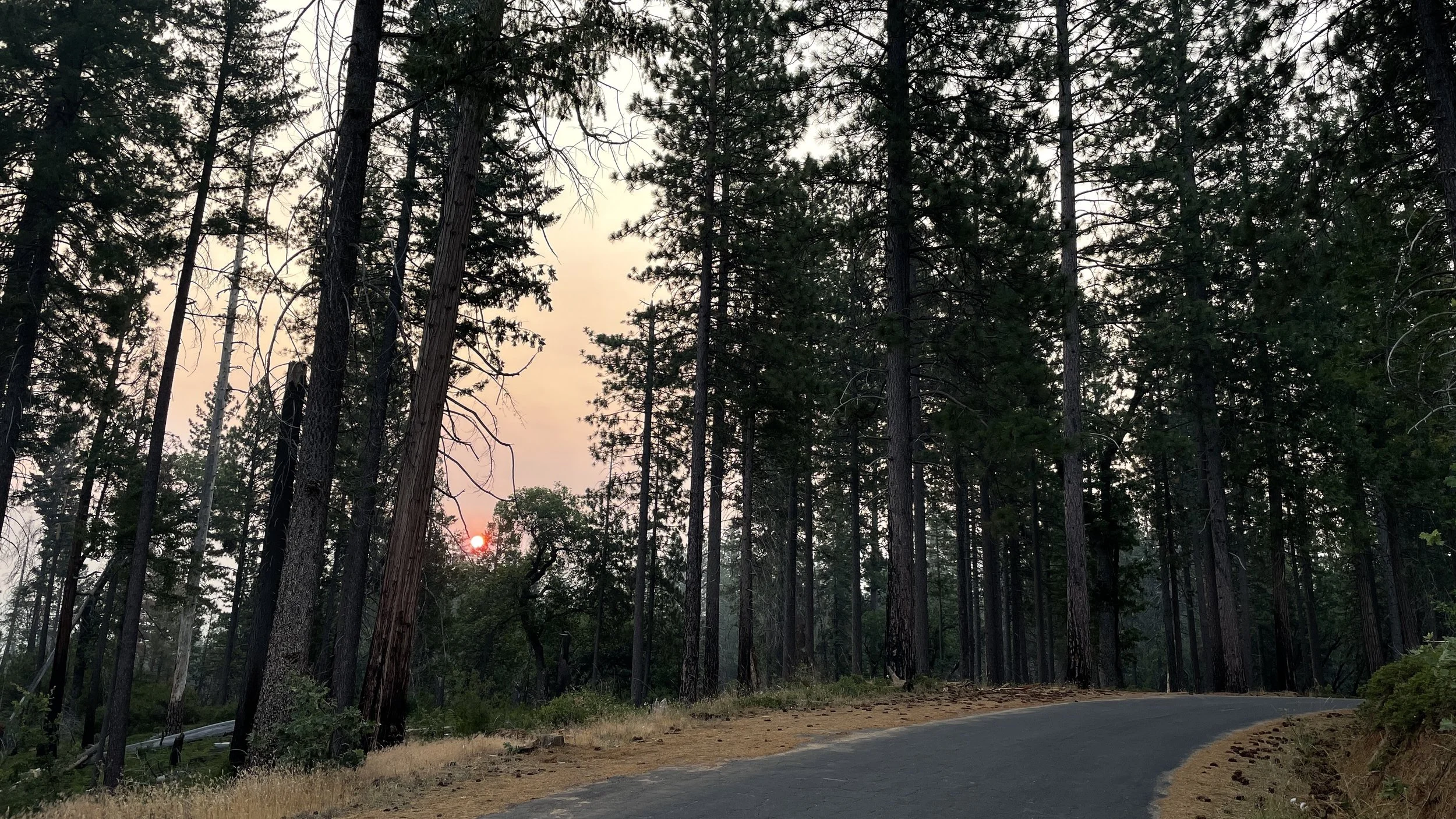
Some quick googling before our trip had led me to bookmarking Hardin Flat Road just outside Yosemite as a promising location for a dispersed campsite. We made the 40-ish minute drive before turning onto this hidden loop, supposedly full of dispersed campsites. Being the adventurous type, we immediately began climbing our way into the Stanislaus National Forest expecting to find a beautiful, forested campsite away from other folks with similar plans. Unfortunately, a few miles of climbing the forest road didn’t reveal a single campsite and we decided to turn around and secure a spot along Hardin Flat Road instead.
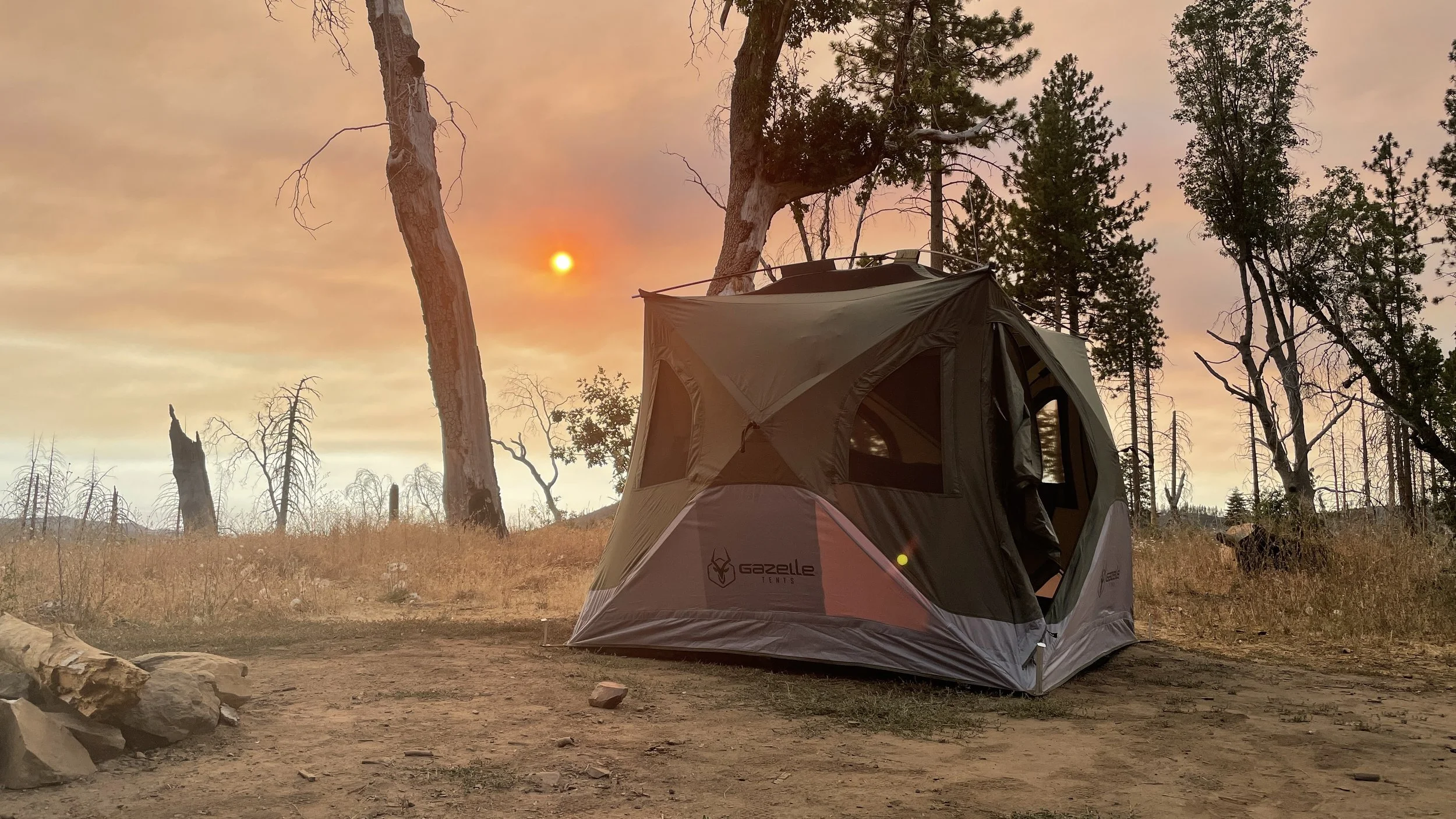
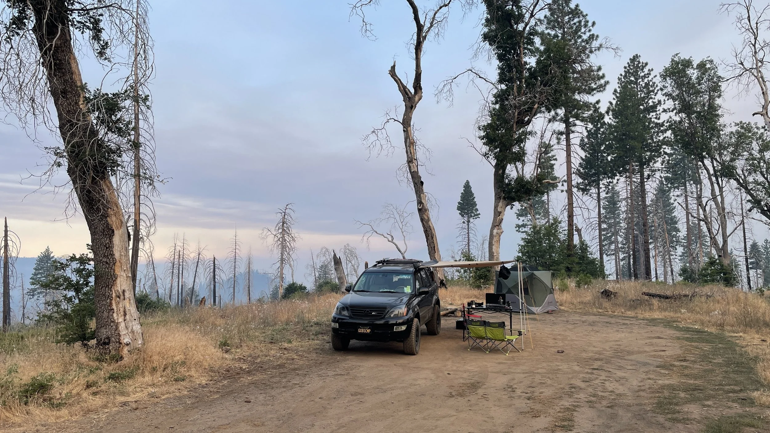
We made our way from the middle of Hardin Flat to the western end of the loop where it dumps out at the Berkeley Tuolumne Family Camp (which resembles something of an old mining town). Also not our speed. In our view, most of the sites west of the Golden Arrow Rd. entry point are less than favorable. So we turned around and headed East on Hardin Flat beyond Golden Arrow Road. Eventually we found a couple of more promising, albeit dusty, sites. We settled on the second, smaller site which sat on a nice high point overlooking the Stanislaus National Forest. Also dusty, and closer to the road than we’d prefer, the site was otherwise quite nice. We did see a fair amount of traffic come through after we’d settled in.
Once we’d partaken of a delicious taco dinner, we settled in to enjoy the sunset before crashing for the night.

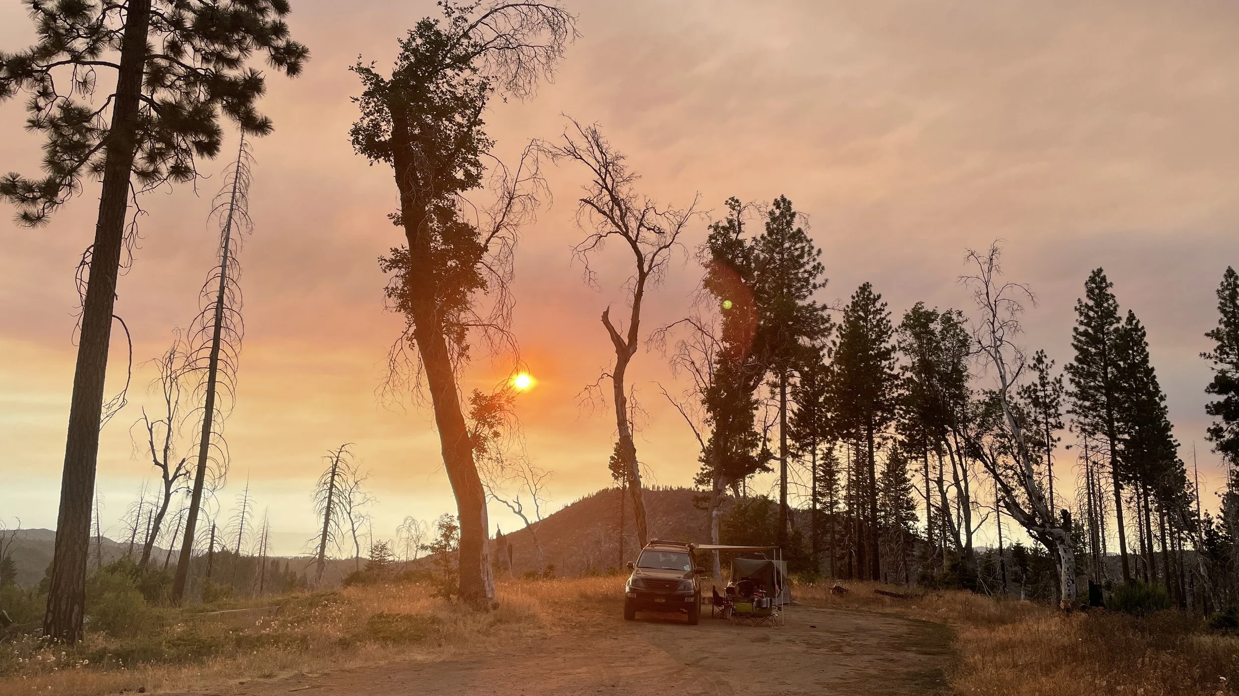
Opting for an early start on Sunday morning, we arose to find that the winds had shifted, bringing the smoke from the nearby fire ever closer. With the smell of burning wood thick in the air, we packed up the basecamp rig and headed out for what would prove to be an epic day.

As we headed East on Hardin Flat Road, we discovered our mistake the previous day. The worthy campsites (not that ours wasn’t) are all located East of Golden Arrow Rd. and West of Big Oak Flat Road. If you’re headed to the area to camp, use the Rush Creek Lodge entrance to Hardin Flat Rd. and work your way westward until you find something to your liking. There are also a number of forest service roads off Hardin Flat that will take you deeper into the Stanislaus National Forest. (We didn’t explore much in that direction, so no comment on potential campsites.)

We were worried that we’d encounter another long wait to enter Yosemite, but those concerns proved unfounded. (Pro-tip: if you’re heading into the park during peak season, try not to use the West Entrance.) We literally drove right in with a friendly wave from the park ranger. After a quick fuel stop at one of the park gas stations (at Big Oak Flat Rd. and Highway 120) where we were surprised to find that gas was no more outrageously costly than outside the park, we headed East across 120 toward the Tioga Pass entrance.
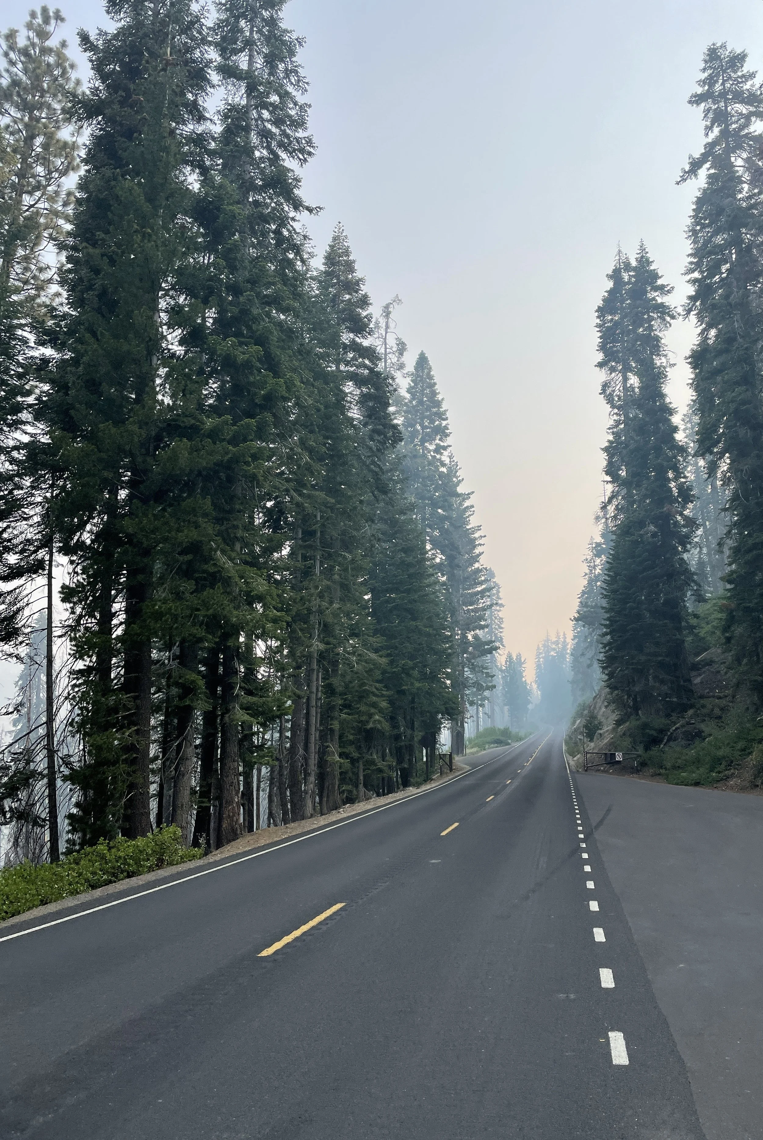
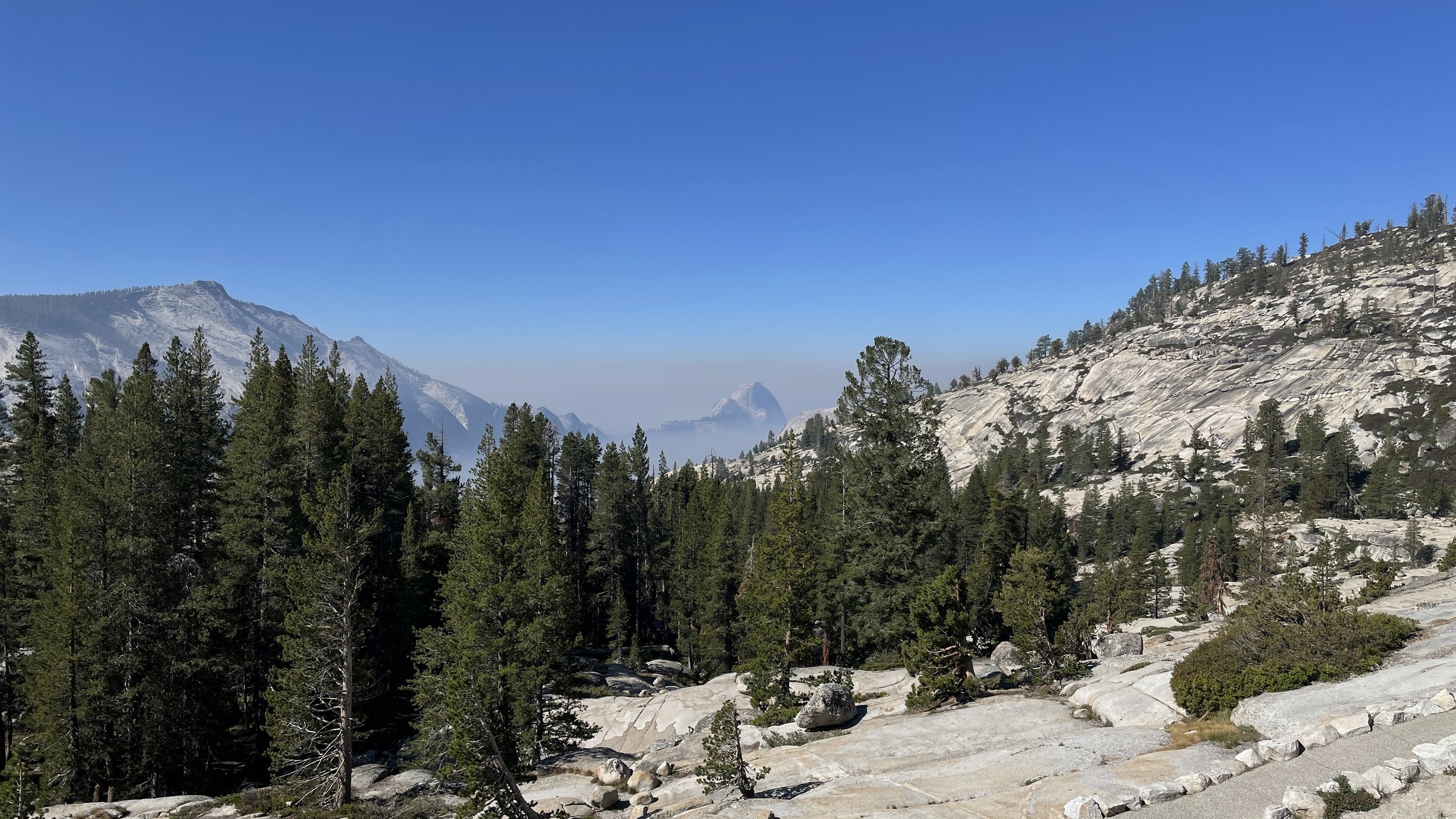
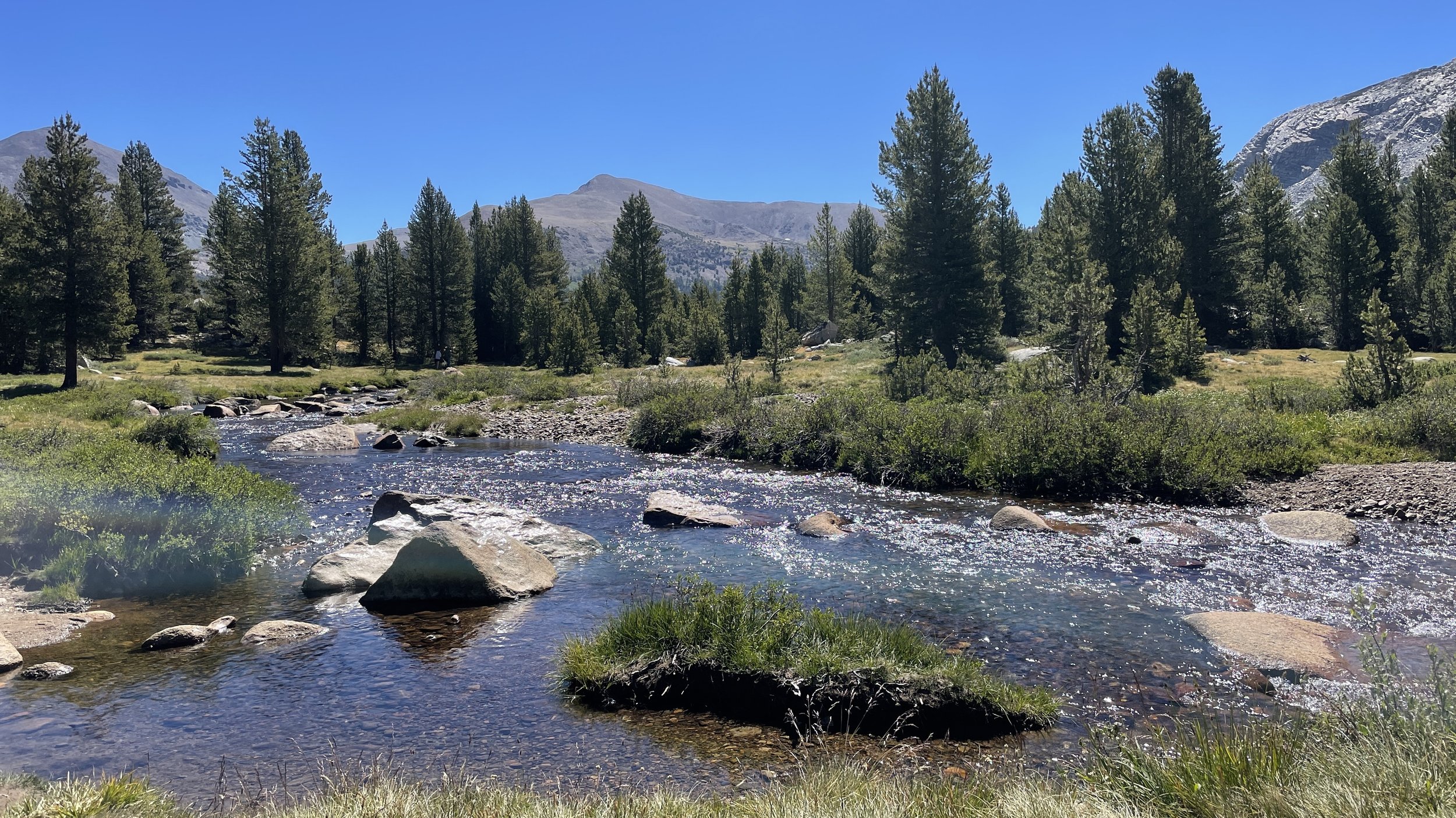
The drive through the Yosemite high country and the Tuolumne area is one of the most outrageously beautiful drives you might do. It begins along a ridgeline which offers stunning views in both directions (when not socked in with fire smoke) and generally gets better as you go. We took our time, meandering along the highway at a leisurely pace and gladly pulling over to let faster traffic breeze by as they missed the sights we were soaking up.

Eventually the view opens up and looks out toward Yosemite Valley across the high country.

Olmstead Point is a can’t-miss stop along the way. Offering views all the way out to Half Dome in Yosemite Valley, they say you can see climbers ascending the Cables Route up the backside on a clear day. Needless to say, we didn’t have a clear day by any stretch, but the smoke did begin to clear as we moved further East. Eventually we were treated to crystal clear skies over pristine meadows and meandering creeks to finish off our Yosemite adventure.
Next stop on the list as we descended from Tioga Pass down to 395 was the infamous Whoa Nellie Deli. Well known along the 395 corridor, we were seriously looking forward to their breakfast burrito. Much to our chagrin, however, we arrived about 30 minutes after breakfast service ended. (Seriously folks, if you’re known for your breakfast burrito, don’t stop breakfast service at 10:45am please.) We settled for some fish tacos and veggie chili, but honestly we left a little disappointed with both options. Oh, and the gas was well over $7/gal.
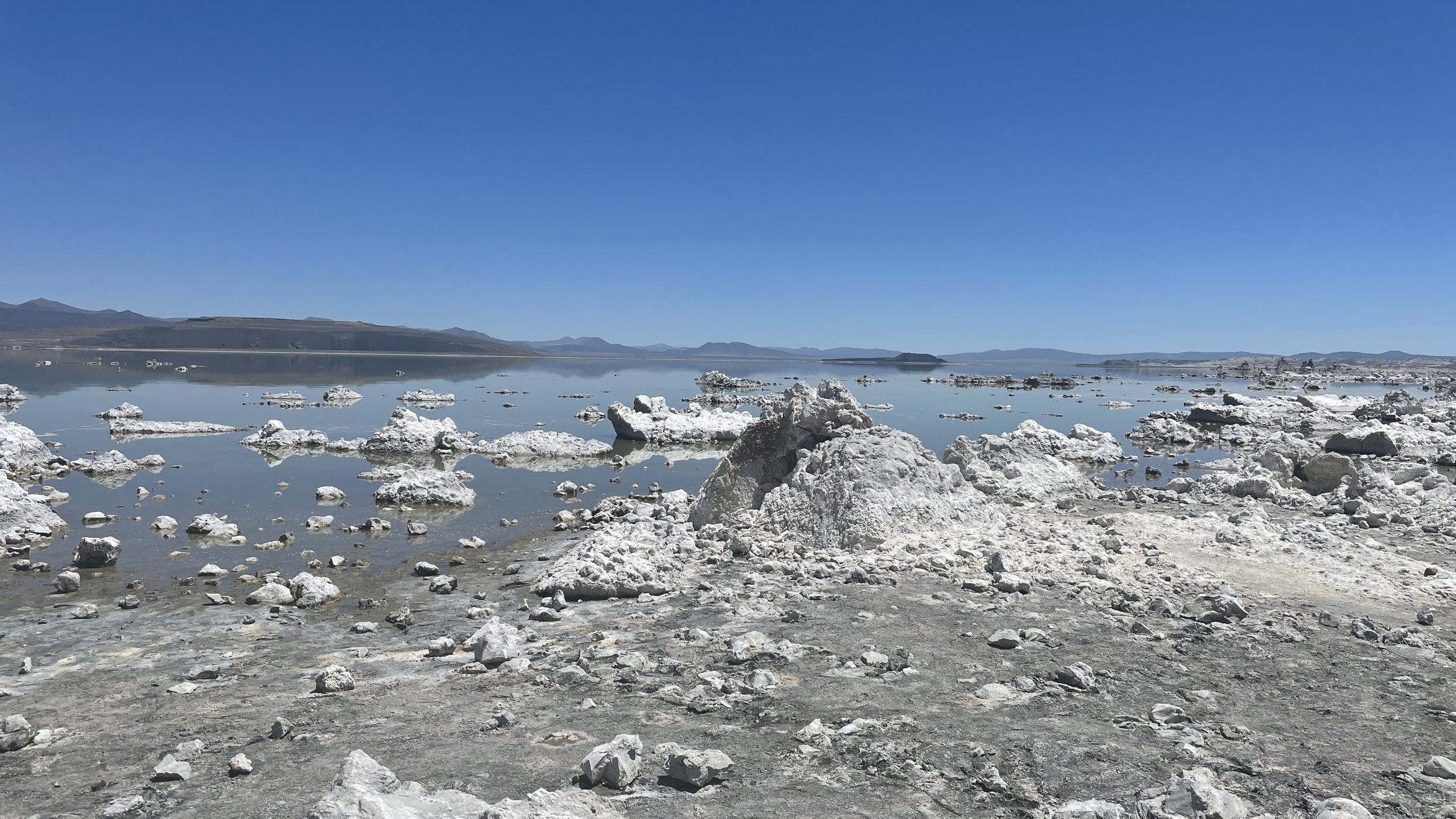
Onward to Mono Lake.
While not a whole lot to see, this seemed like a must stop at least once kind of venture. Instead of heading to the visitor center, we opted for the quick pull-off of 395 another mile or so down the road. That was a mistake. There’s some small tufa near that parking area, but the visitor center is the closest point to the most impressive tufa features on this side of the lake. With a pup in tow and temperatures in the 90’s, we opted to skip the hike around the lake’s edge and make this a short stop before hopping back in the basecamp rig.
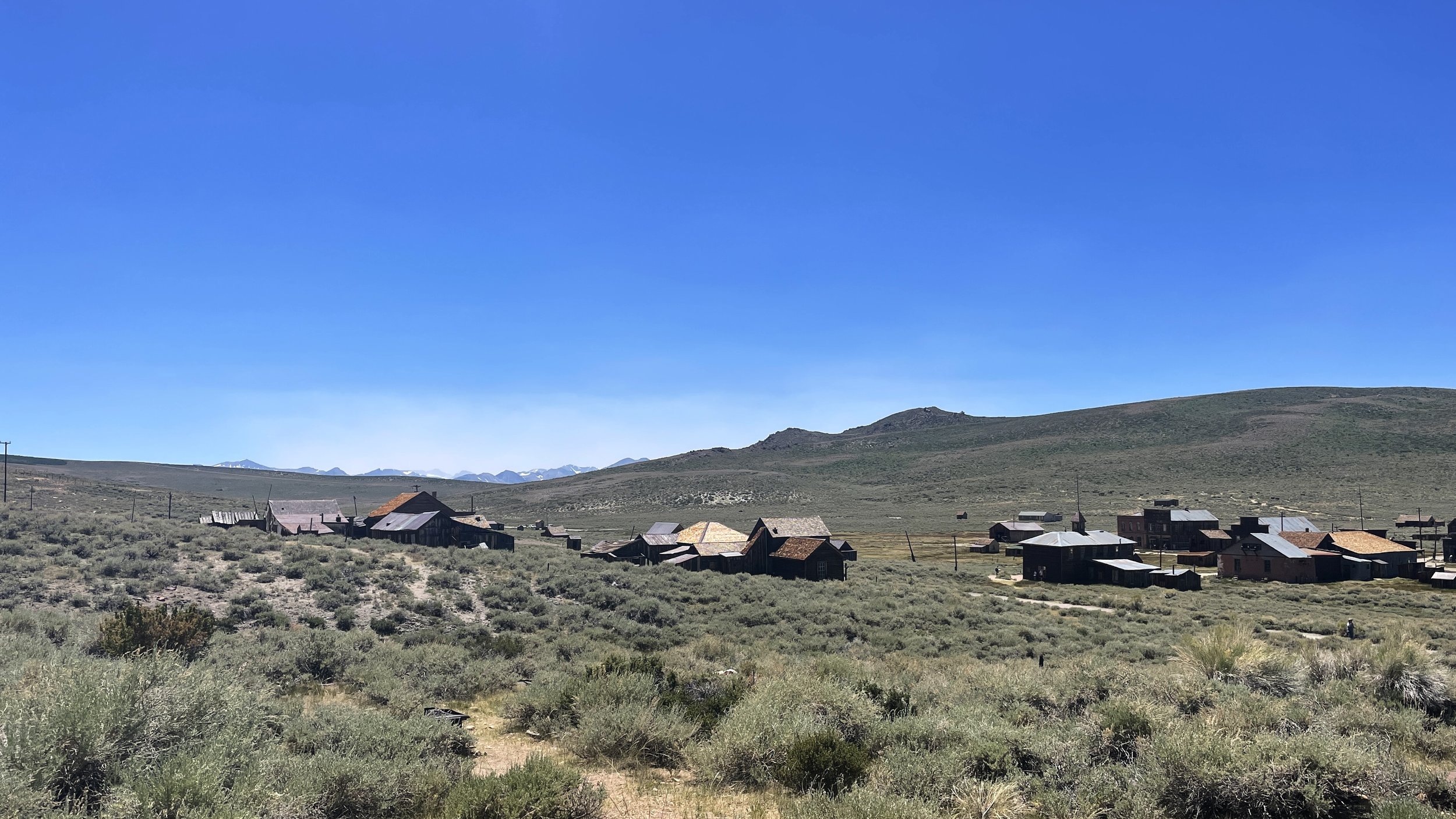
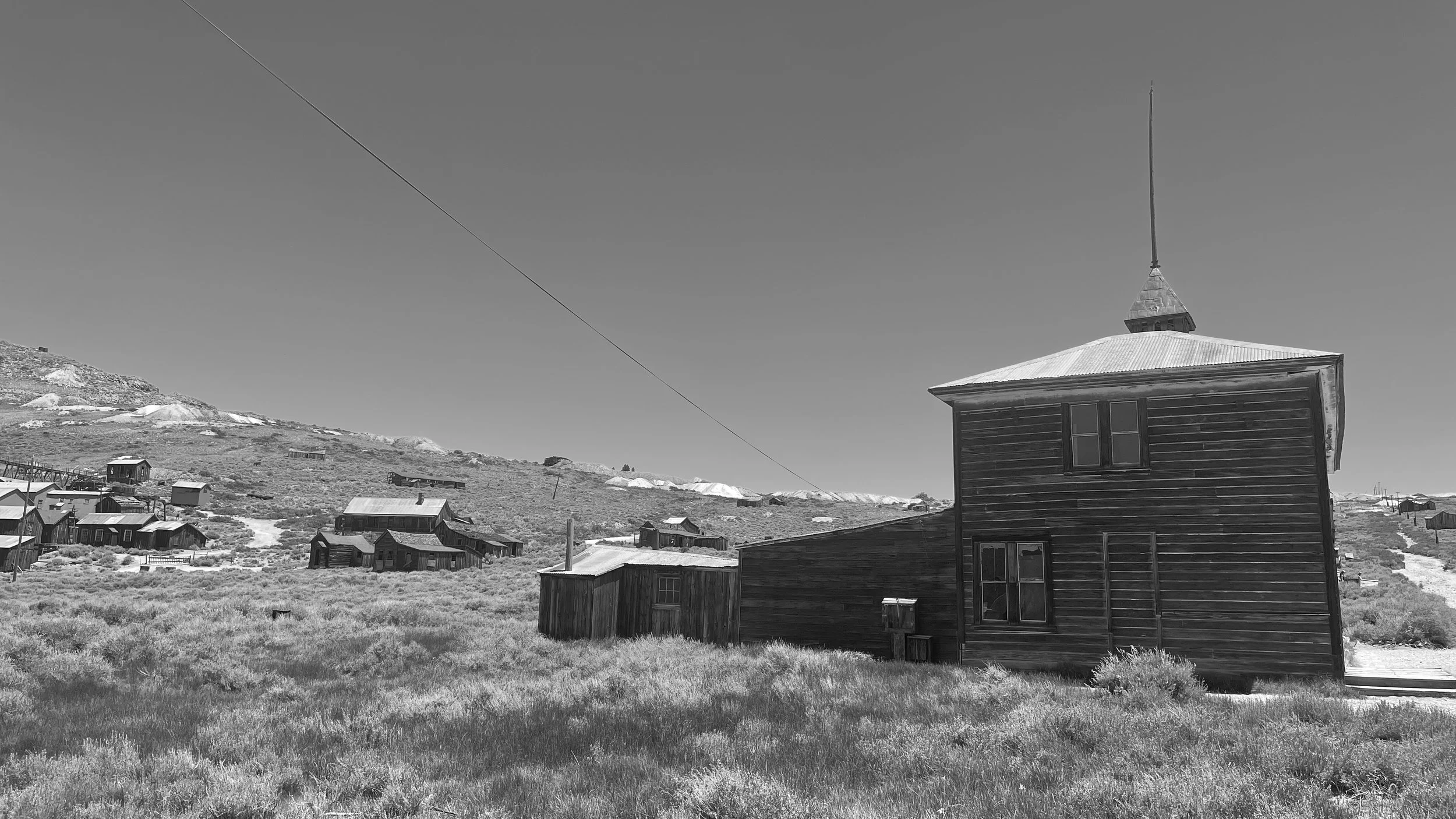
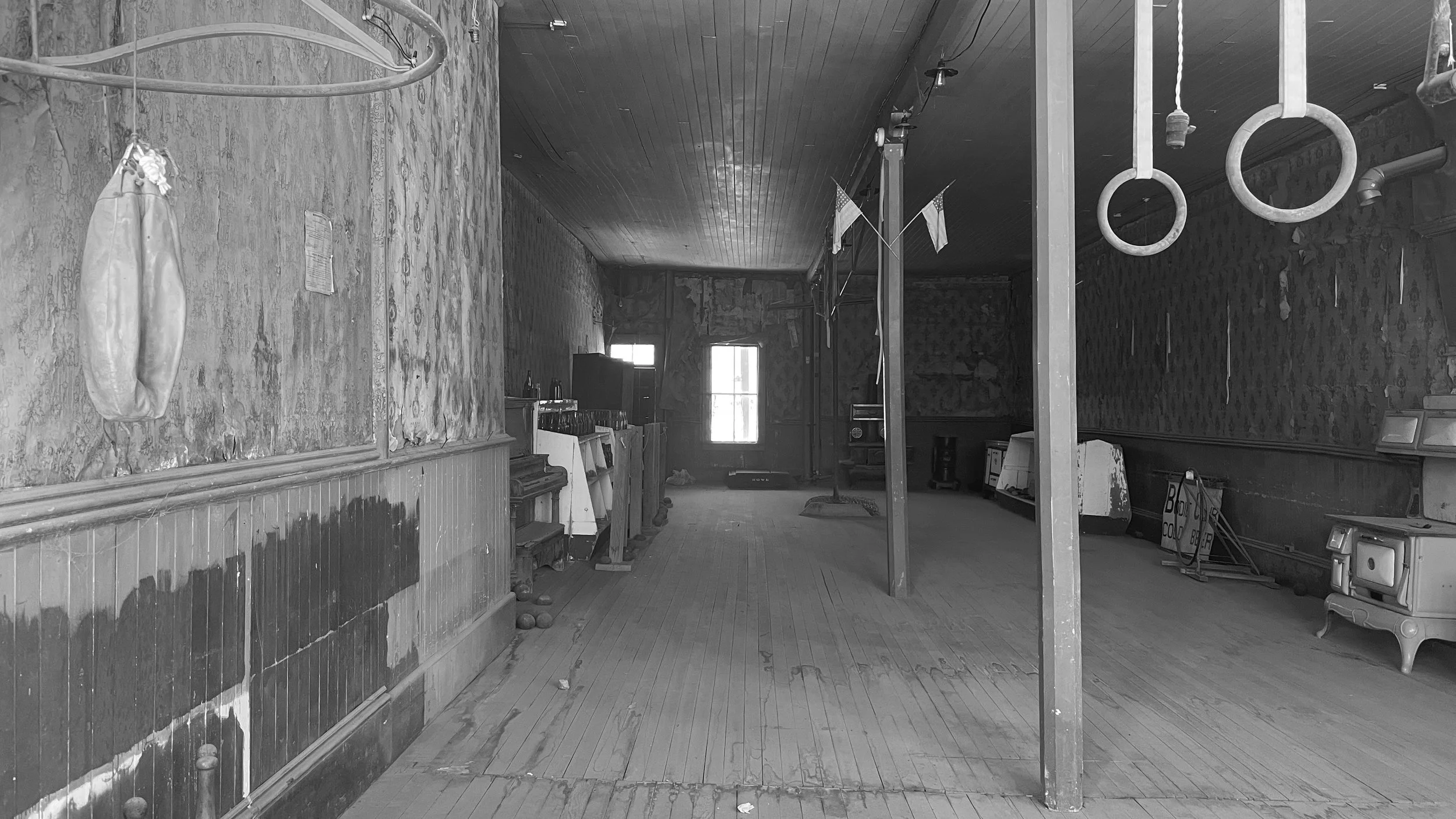
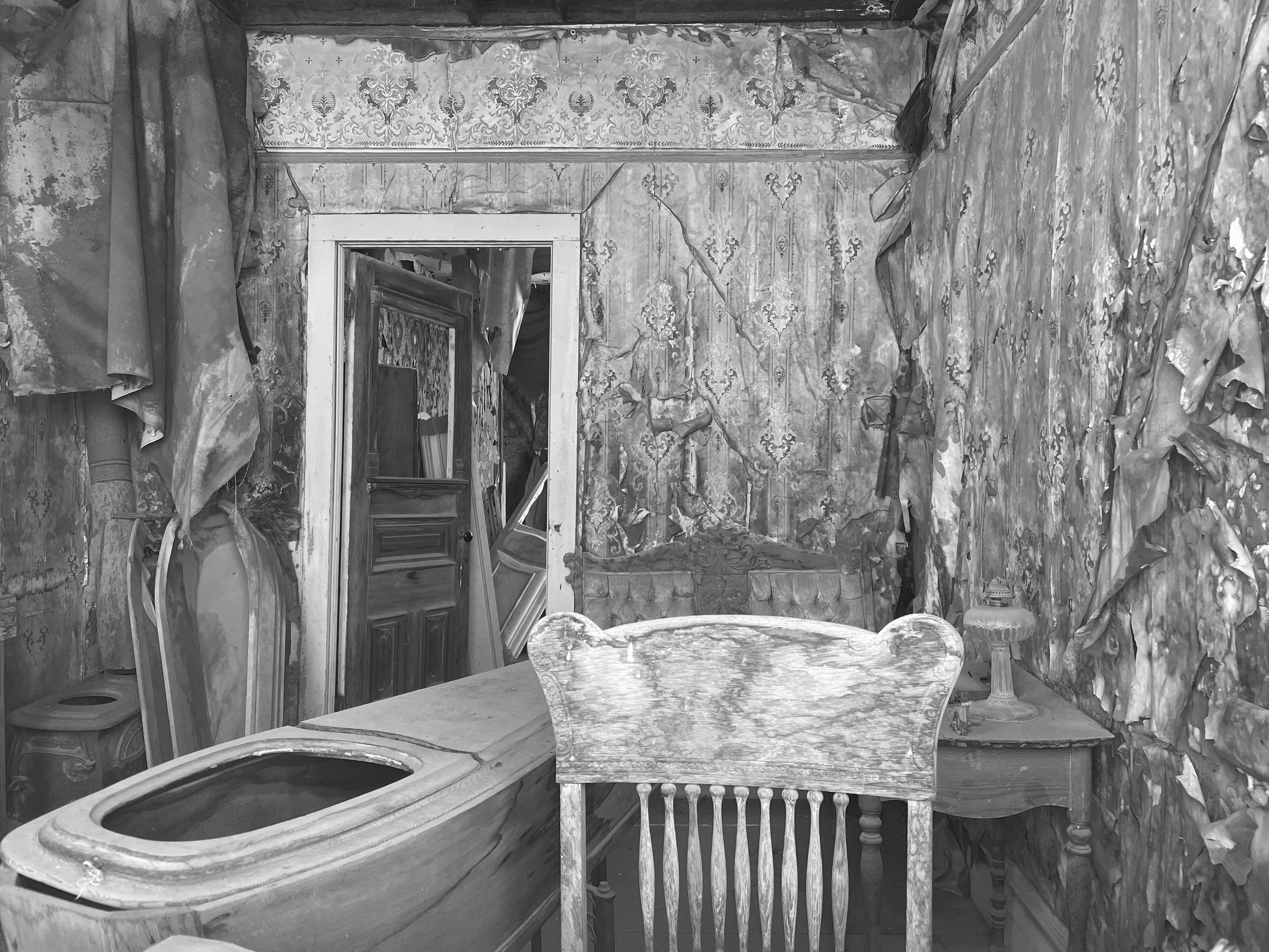
After Mono Lake, we headed to Bodie State Historic Park, home to Bodie Ghost Town. We’re not history buffs by any stretch, so we weren’t entirely certain whether this stop would grab our attention. To make a long story short, Bodie is well worth a visit regardless of your proclivity toward historical stories. With roughly 40-50 buildings dating back to the 1800’s Bodie is one of the most well-preserved ghost towns you’ll have the pleasure of visiting.
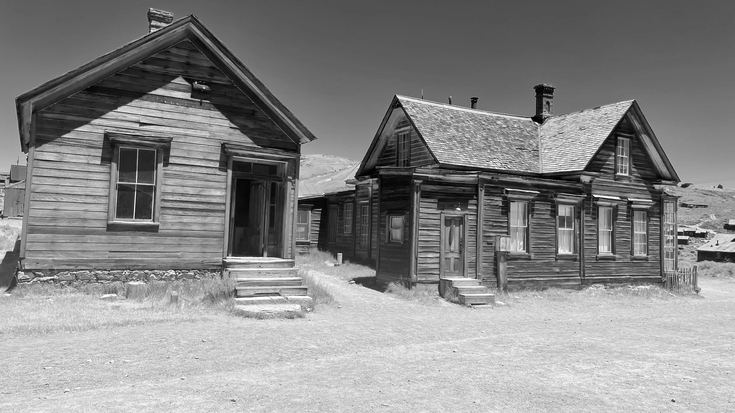
Some of the can’t-miss moments are the gym (don’t forget to get your cardio in) and the morgue (which is right next door — in case you overdo it). The entire town is worth a wander and is pet-friendly (leashes required, of course).


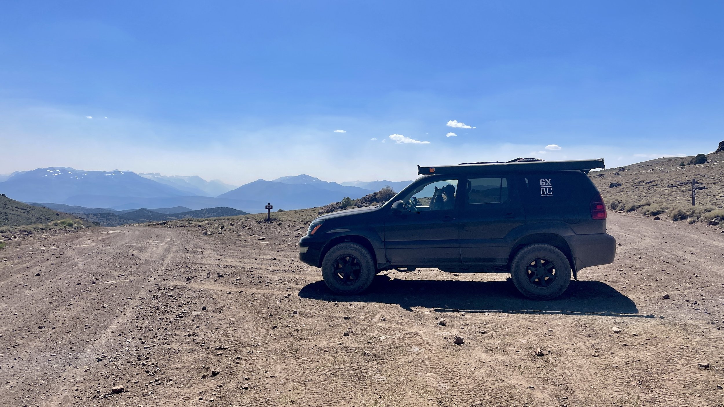
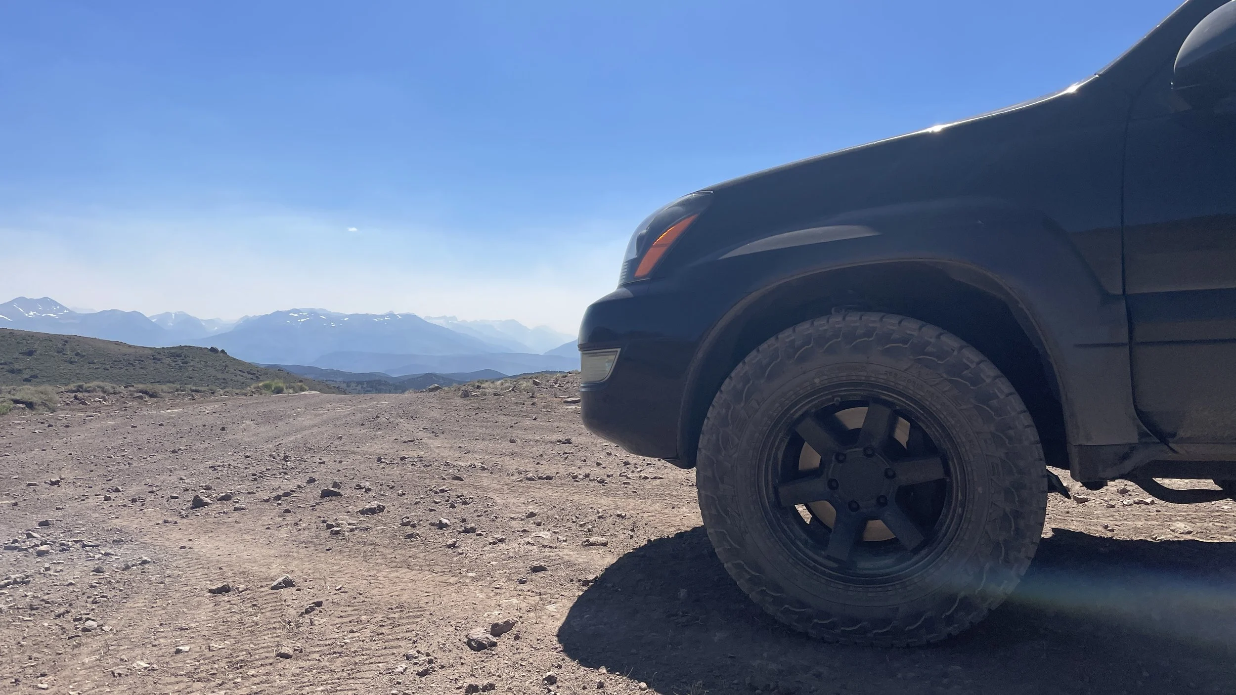
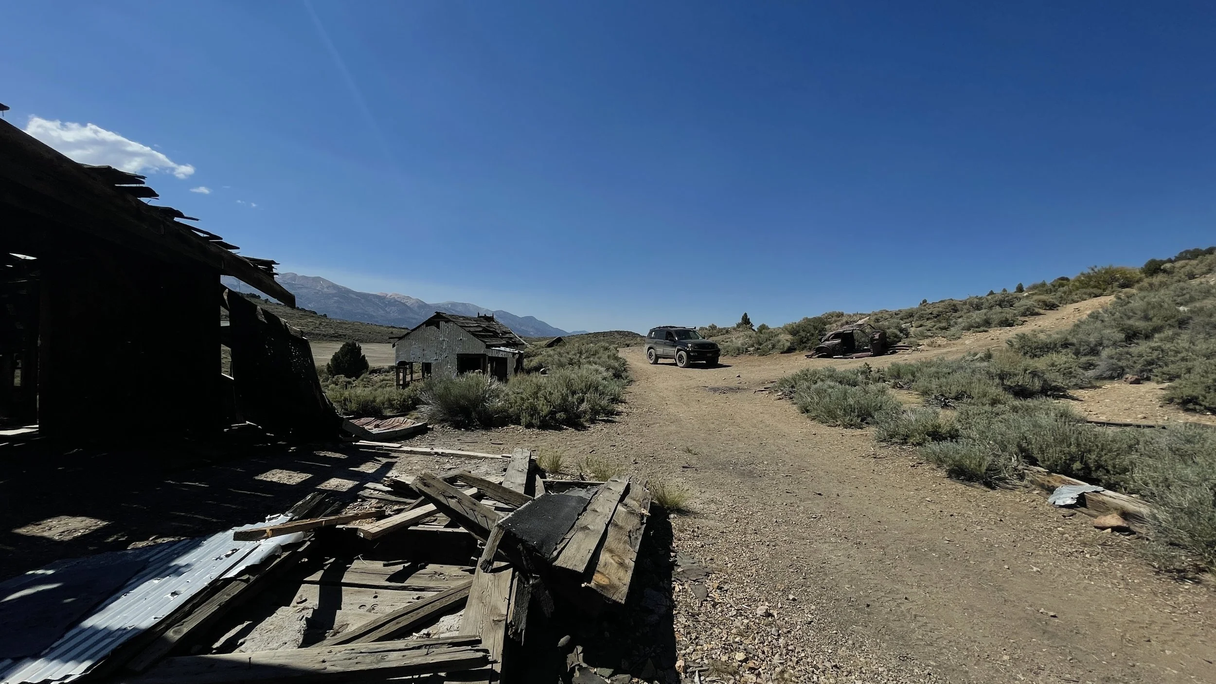
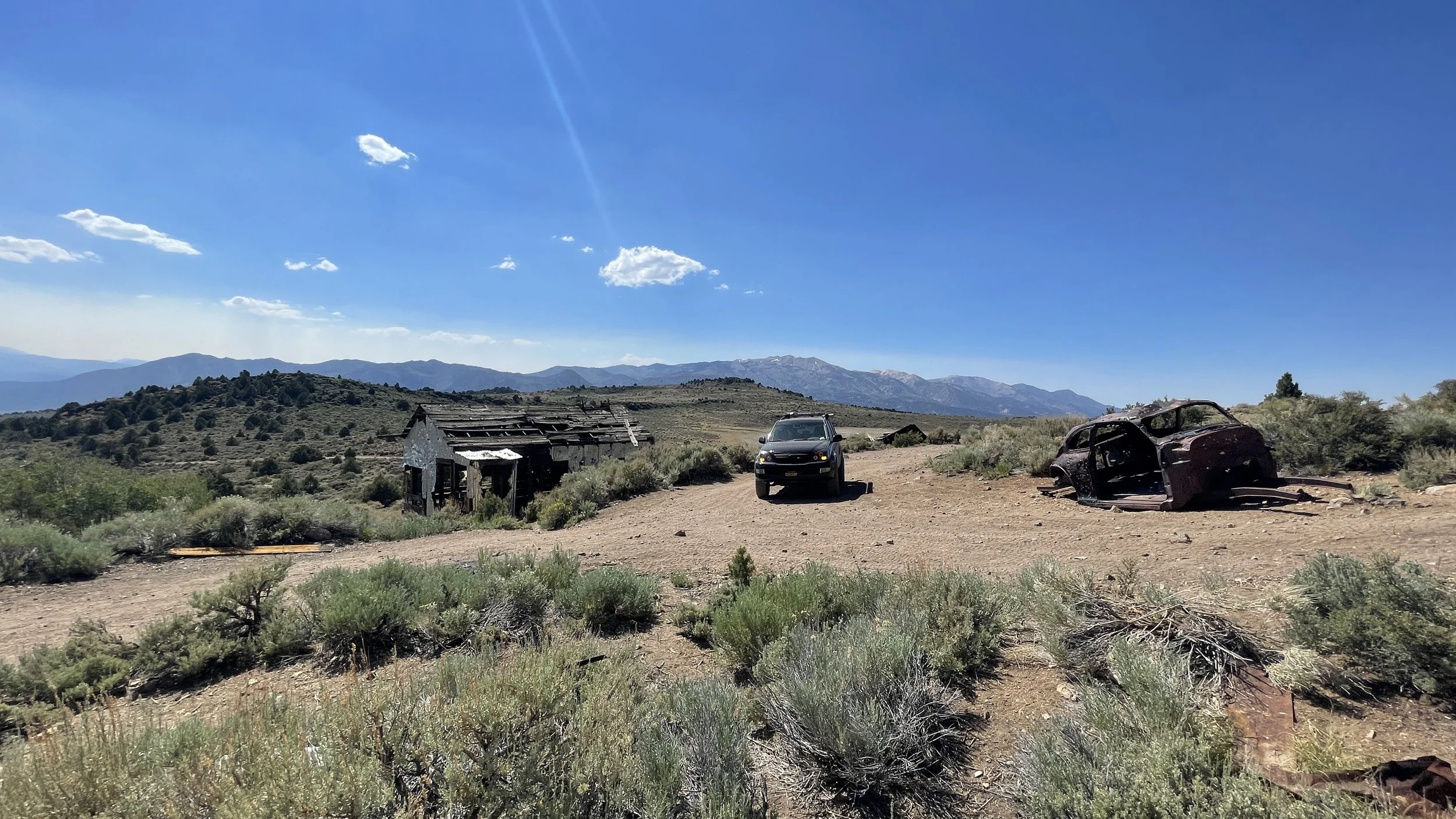
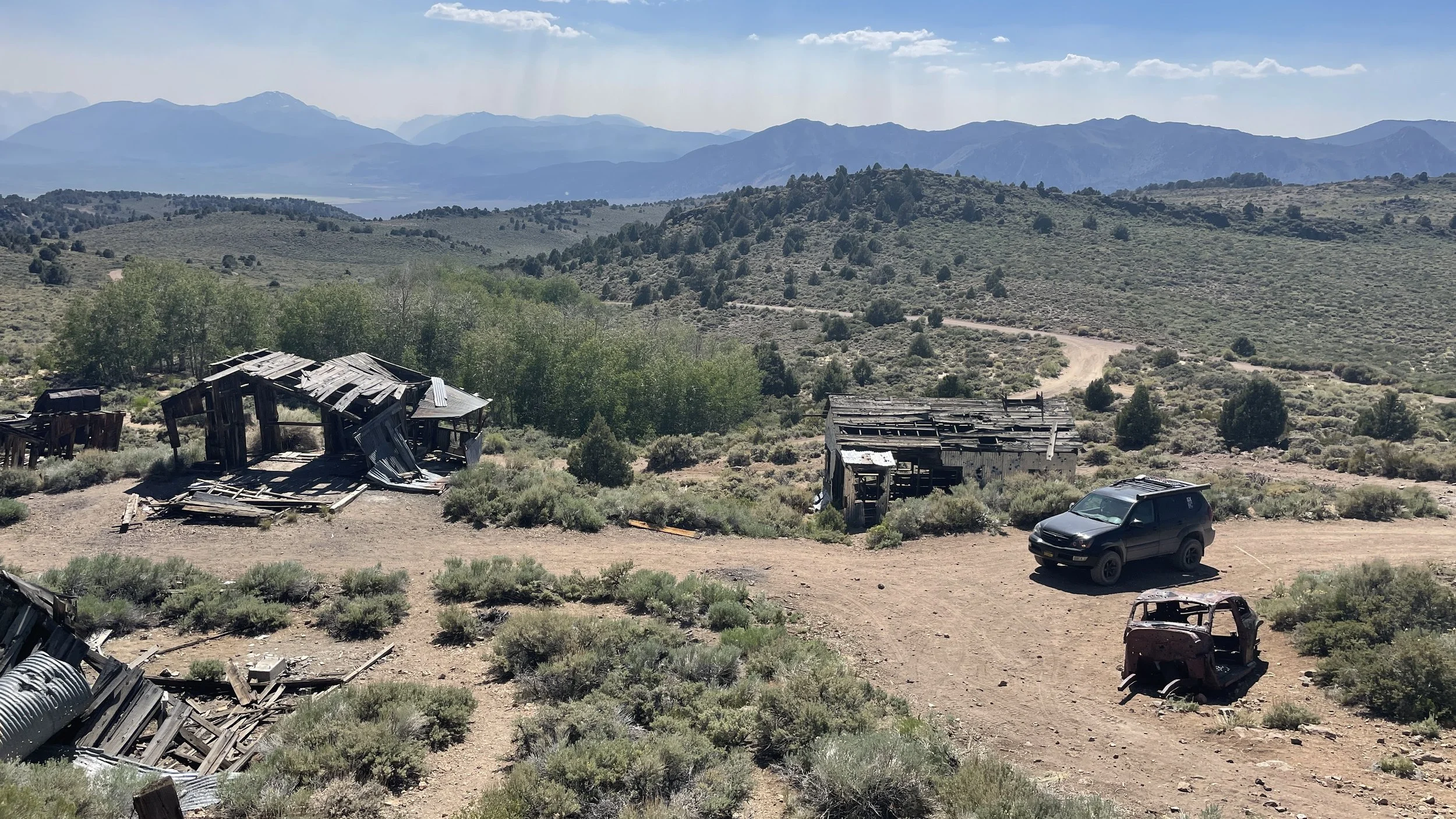
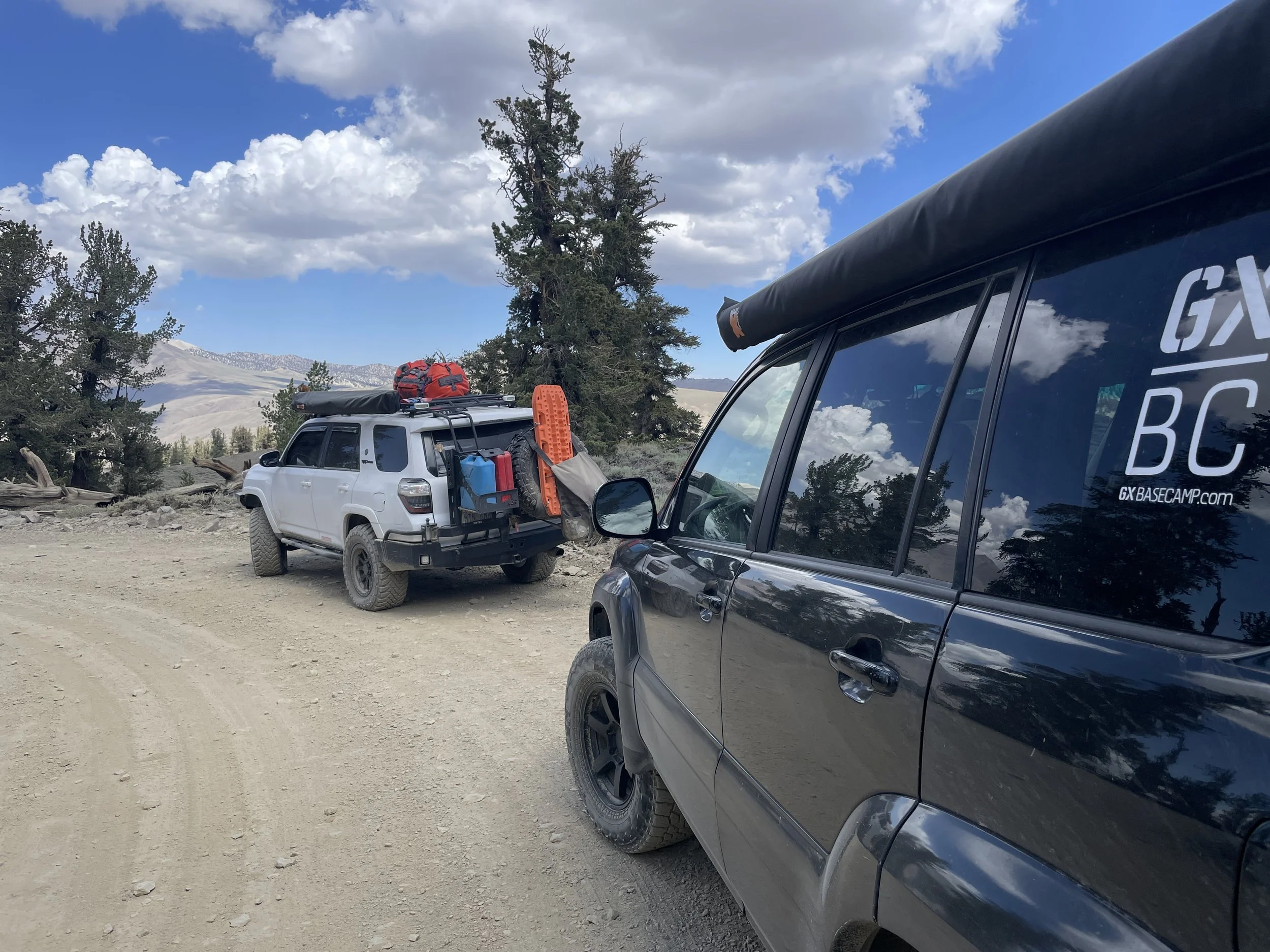
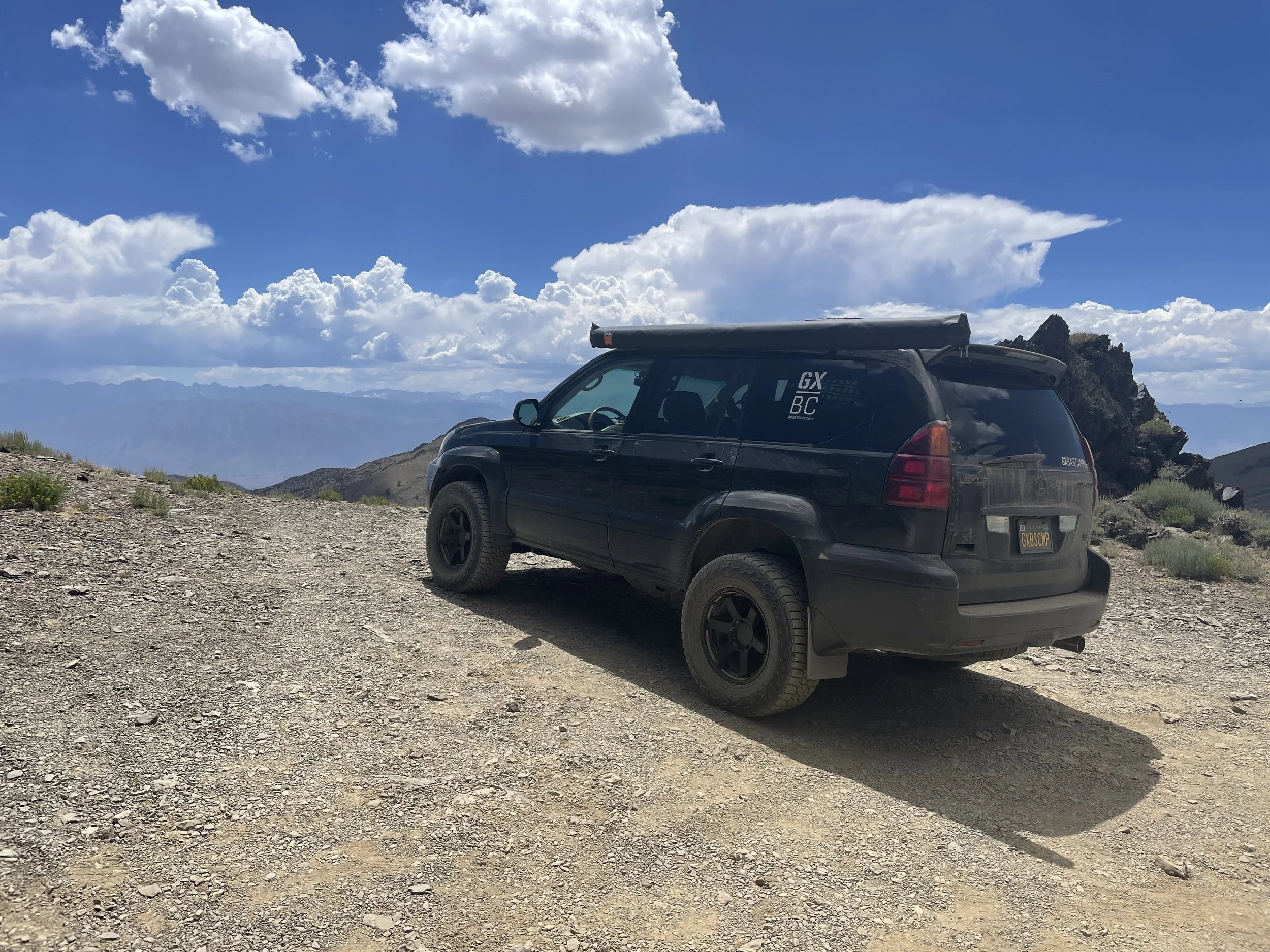
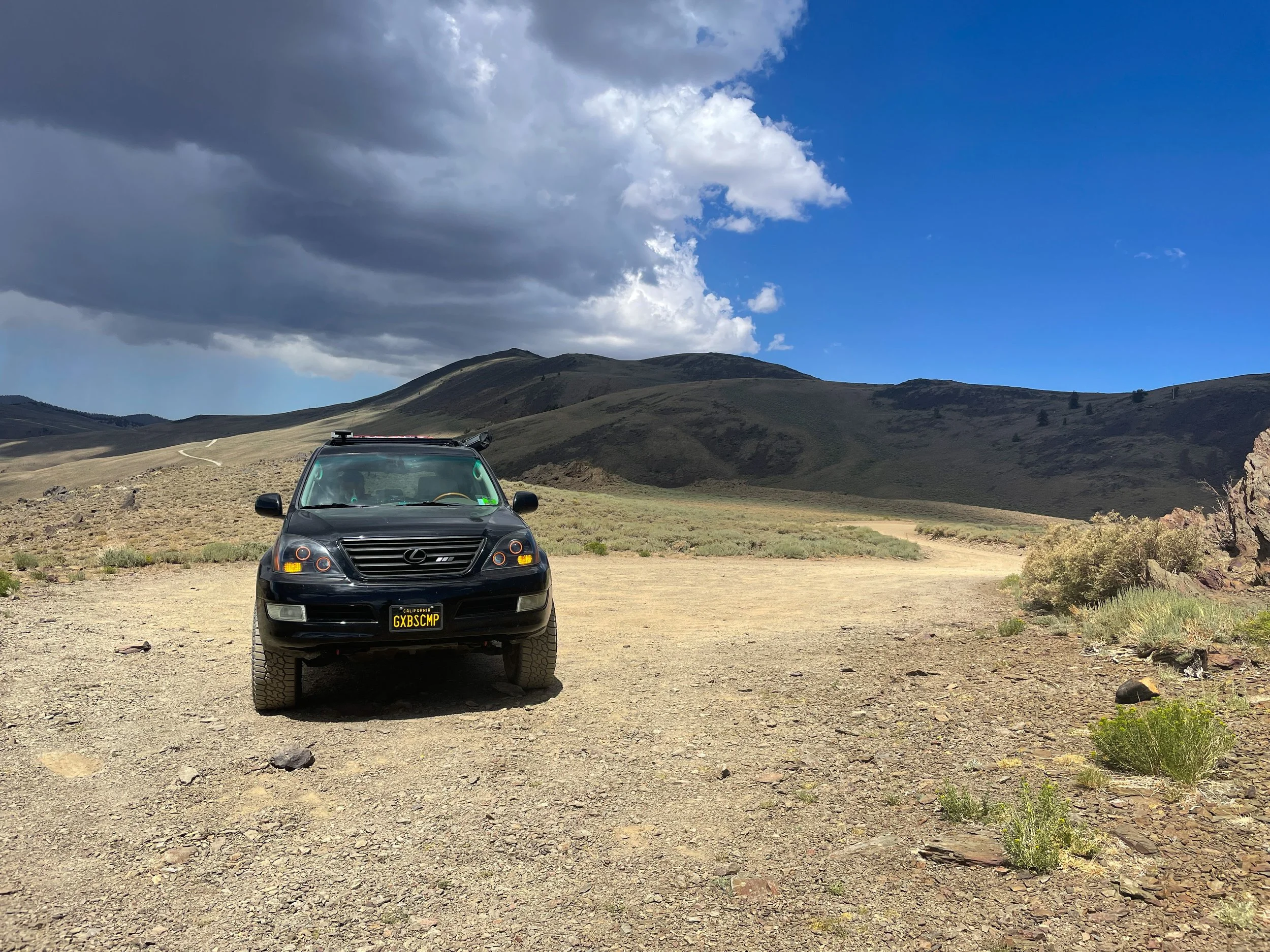
After wandering Bodie, we opted to take the path less traveled out of (ghost) town and head up the dirt Bodie Masonic Rd. This turned out to be one of the best decisions of the trip. This road was a comfortably easy forest service road with epic views and wonderful adventure around every turn. We had an absolute blast touring around the backcountry with no agenda.
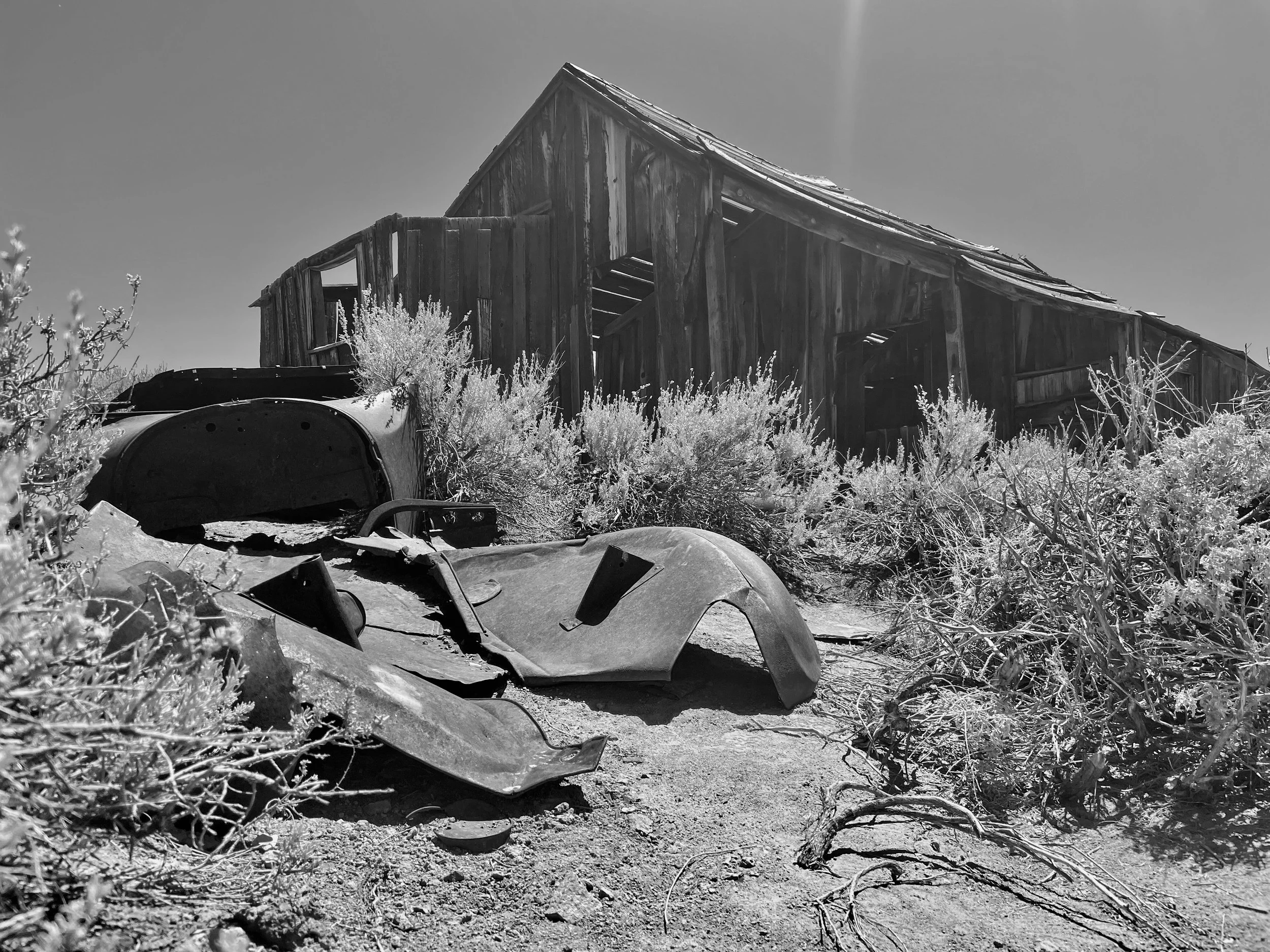
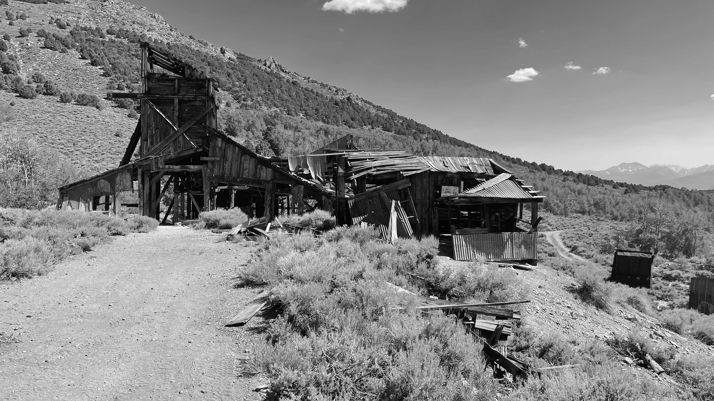
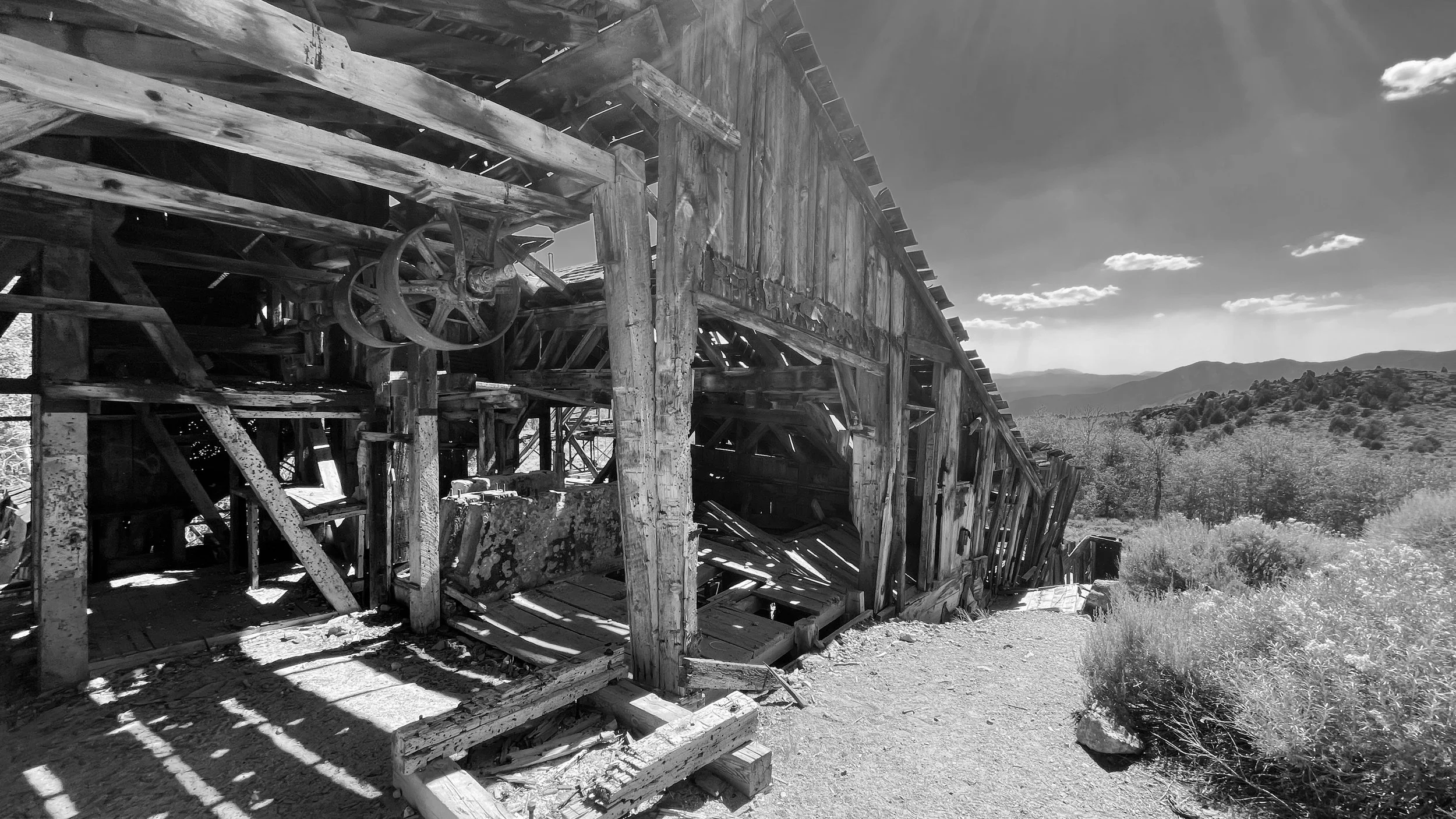
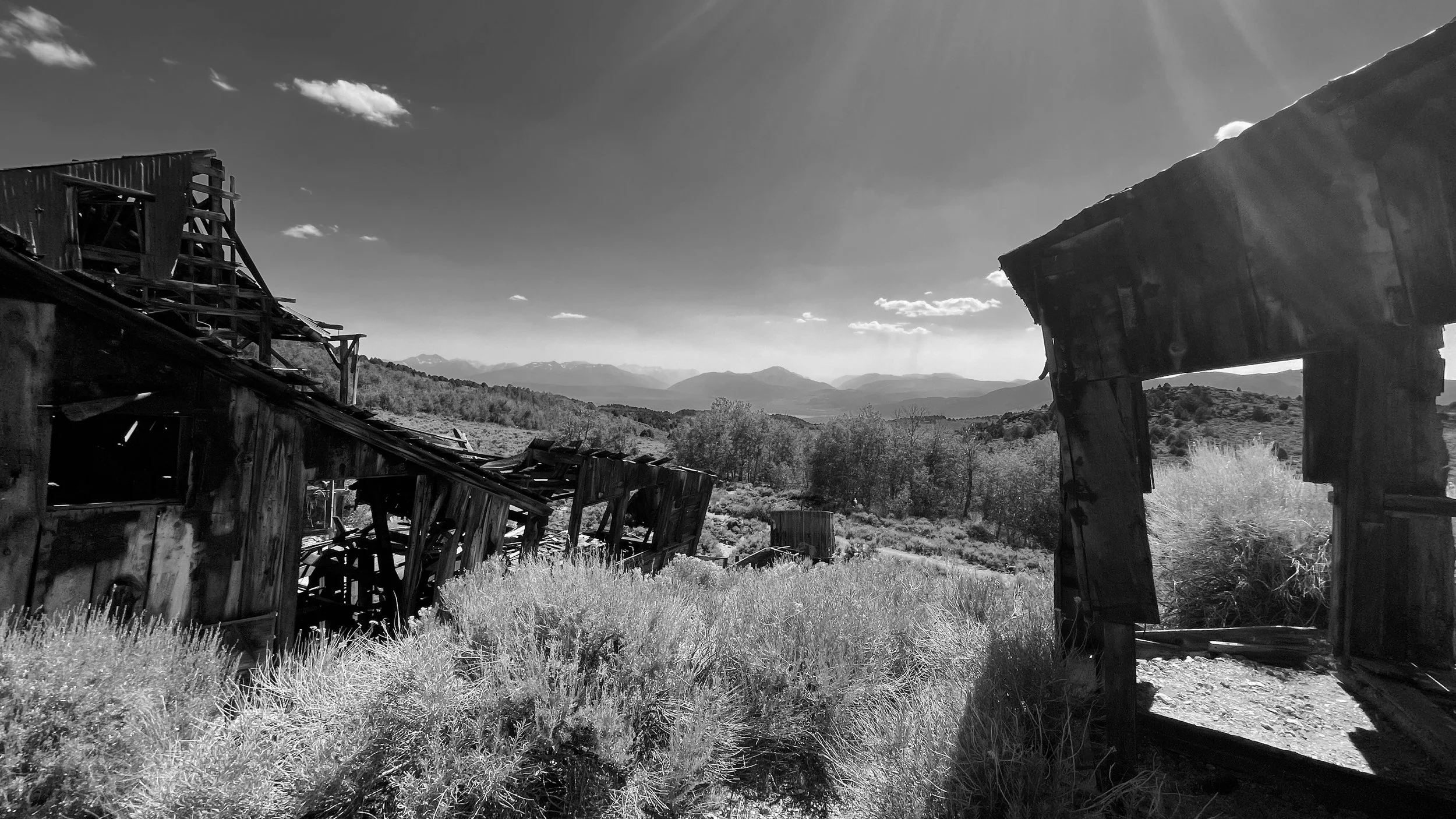
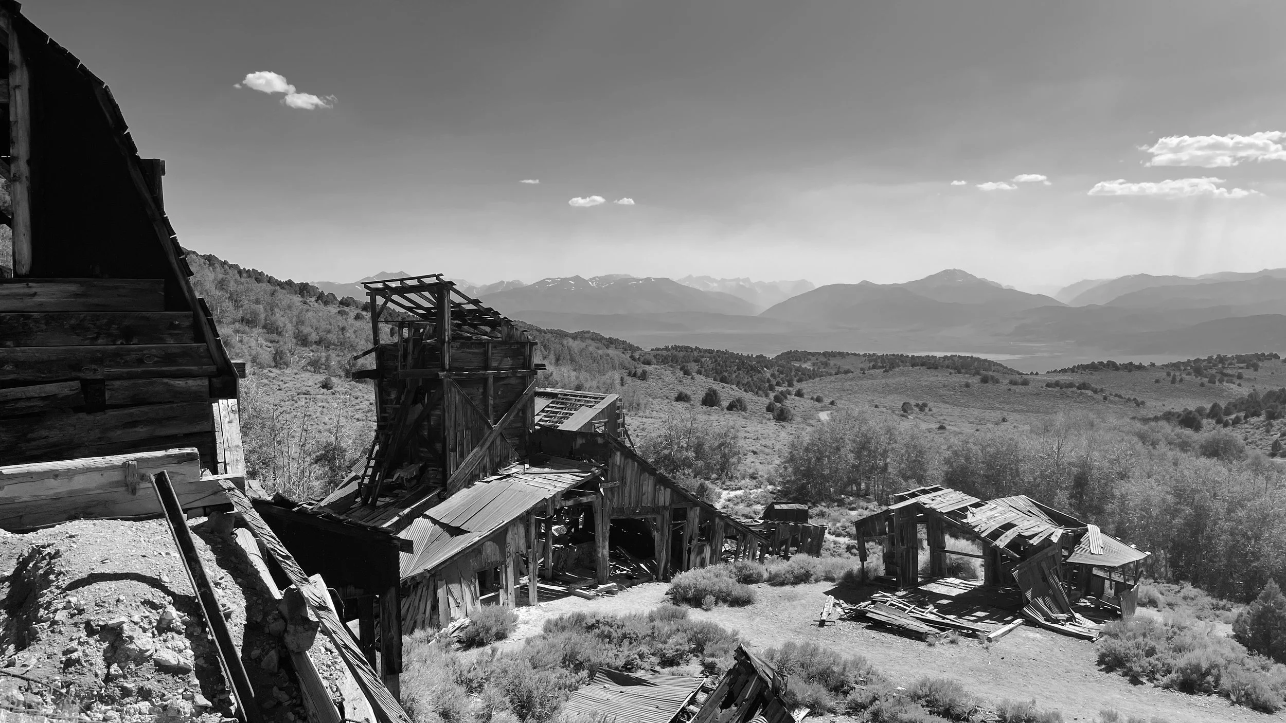
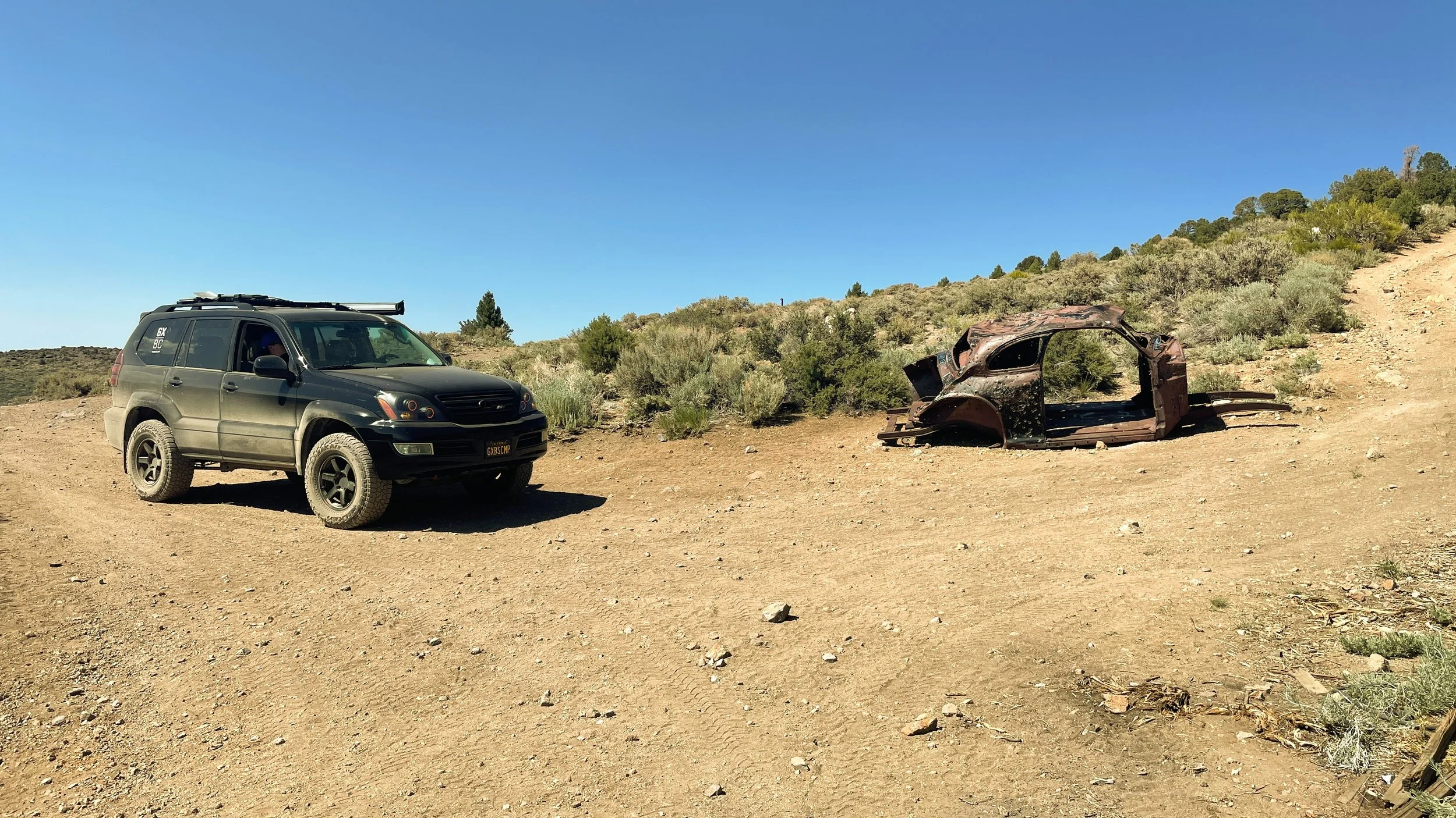
We also stumbled across an abandoned mine during our ventures. Having just seen the fantastic remnants of Bodie, this off-the-beaten-path version was exciting to explore in solitude. We didn’t wander inside any of the buildings because they’re heavily crumbling, but just poking around from the outside was enough to get a sense of the history steeped in these hills.

And, of course, what would a good overlanding adventure be without a few obligatory mall-crawling shots?

Our backcountry adventure finally deposited us next to the Bridgeport Reservoir. From there, it was time to hit the road and roll into our destination for the work week: South Lake Tahoe. The drive up 395 is gorgeous until you find yourself in Nevada. From there, things get a little less interesting. We rolled into our hotel around 6pm feeling throughly fulfilled and rather exhausted from an adventurous Sunday. If you’re looking for a solid place to crash in the area, we enjoyed our stay at The Coachman. A small but nicely renovated motel that features a communal firepit and pool area, a lobby that doubles as coffee shop and bar (featuring happy hour every evening), and a location that’s walkable to restaurants, etc. As with everything in a California mountain town, service is slow, but always with a smile.
We spent the week WFH (working from hotel) and didn’t do a ton of exploring around Tahoe other than an afternoon drive around the lake.
After a week of workationing (it’s a technical term) in South Lake Tahoe, we checked out of the Coachman (after some free Stumptown and a breakfast burrito, of course) and headed south. Destination known: Benton Hot Springs. We spent a night camped here in April and thoroughly enjoyed the whole campsite-with-hot-tub vibe. Unfortunately, this trip would prove…less enjoyable.
After checking in, we rolled over to our campsite, ready to enjoy the afternoon. Those plans, however, were quickly quashed by an utter invasion of biting yellow flies. The moment we stepped out of the truck at our campsite, we were swarmed. We tried to wait it out and see if they’d die down. Didn’t happen. We tried our bug repellent thingimabob from Amazon. Didn’t work. We asked the folks at the Inn if they had any tips — to which they replied “Wear long sleeves.” Didn’t stay.
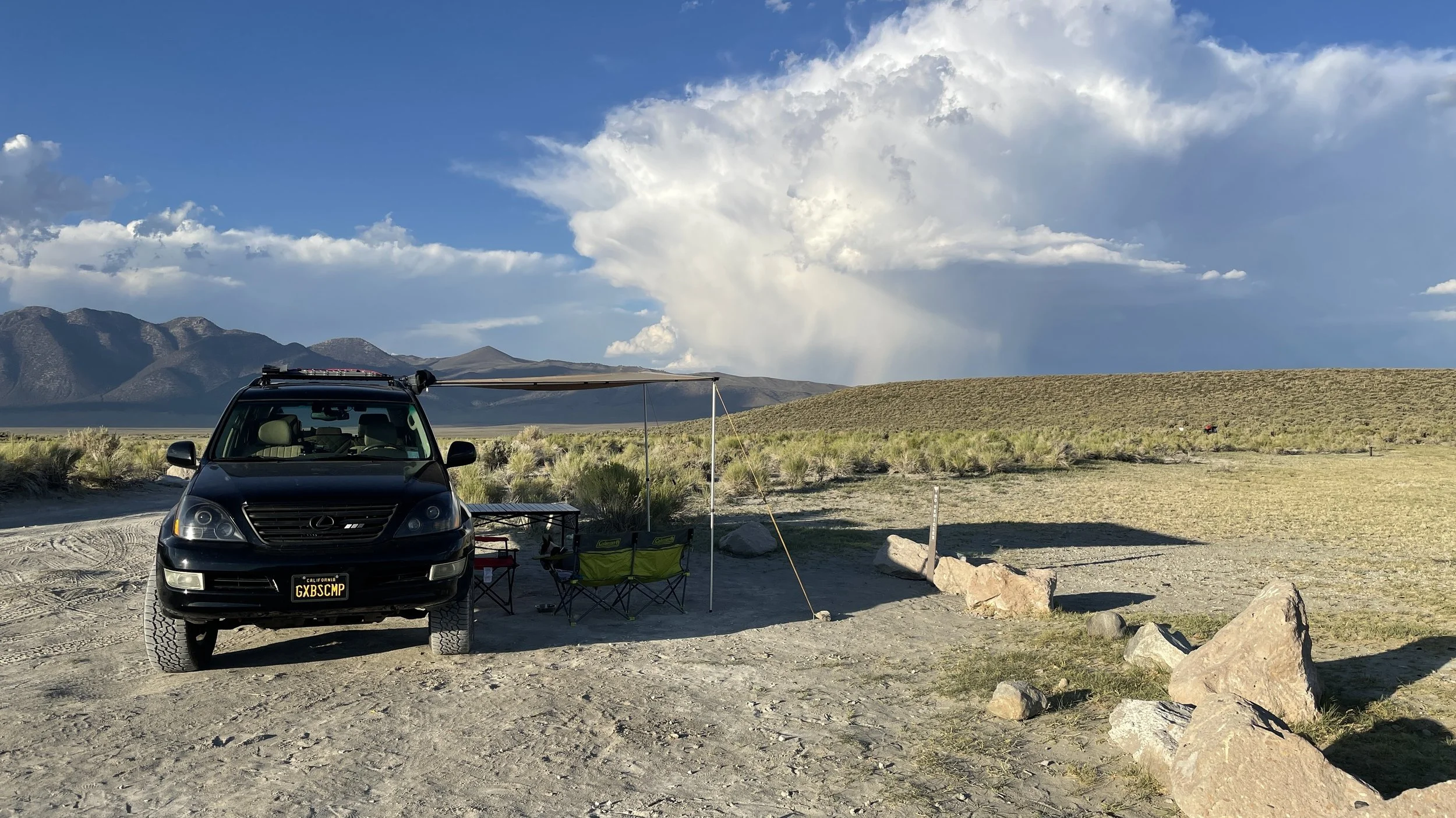
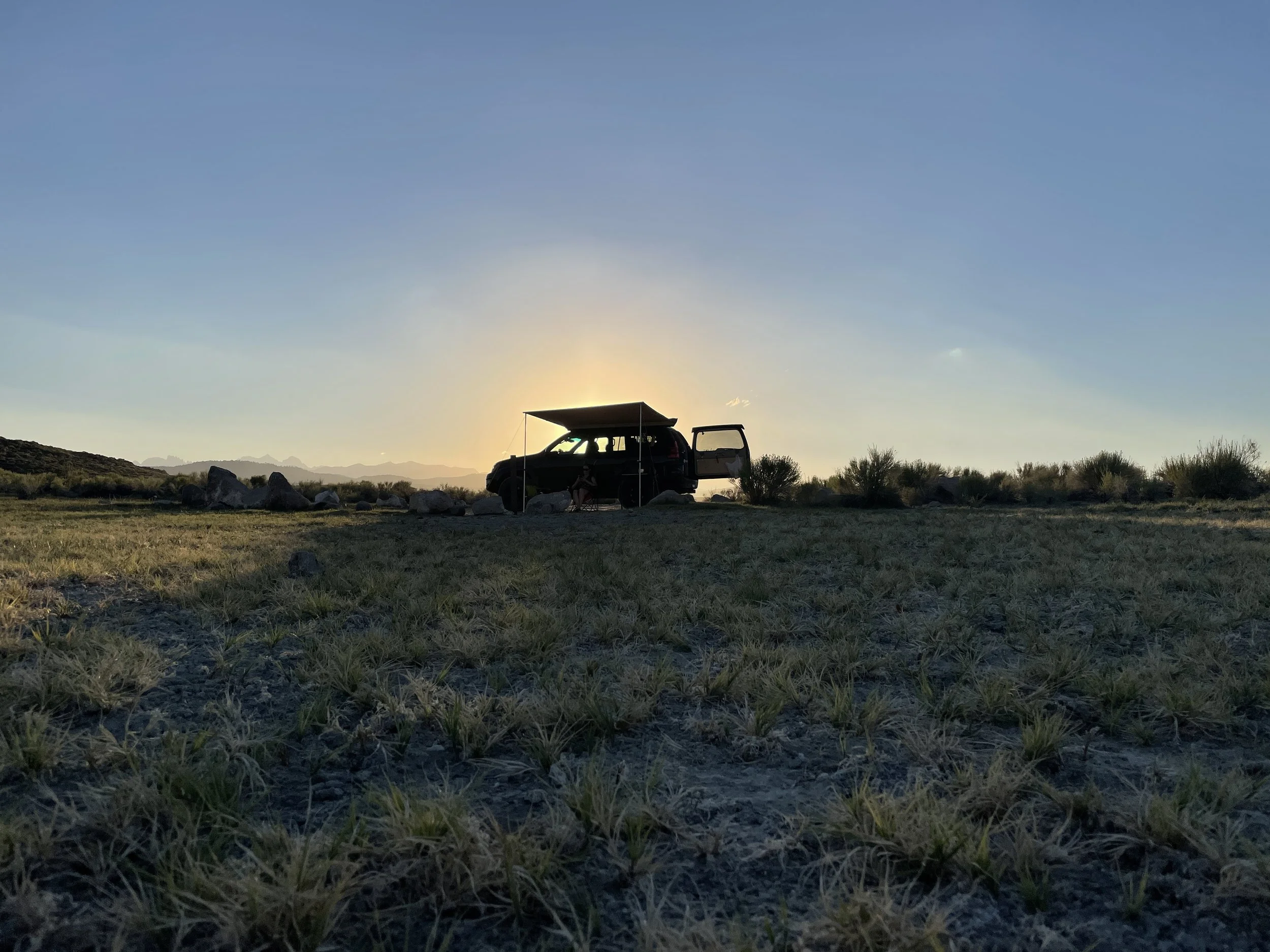
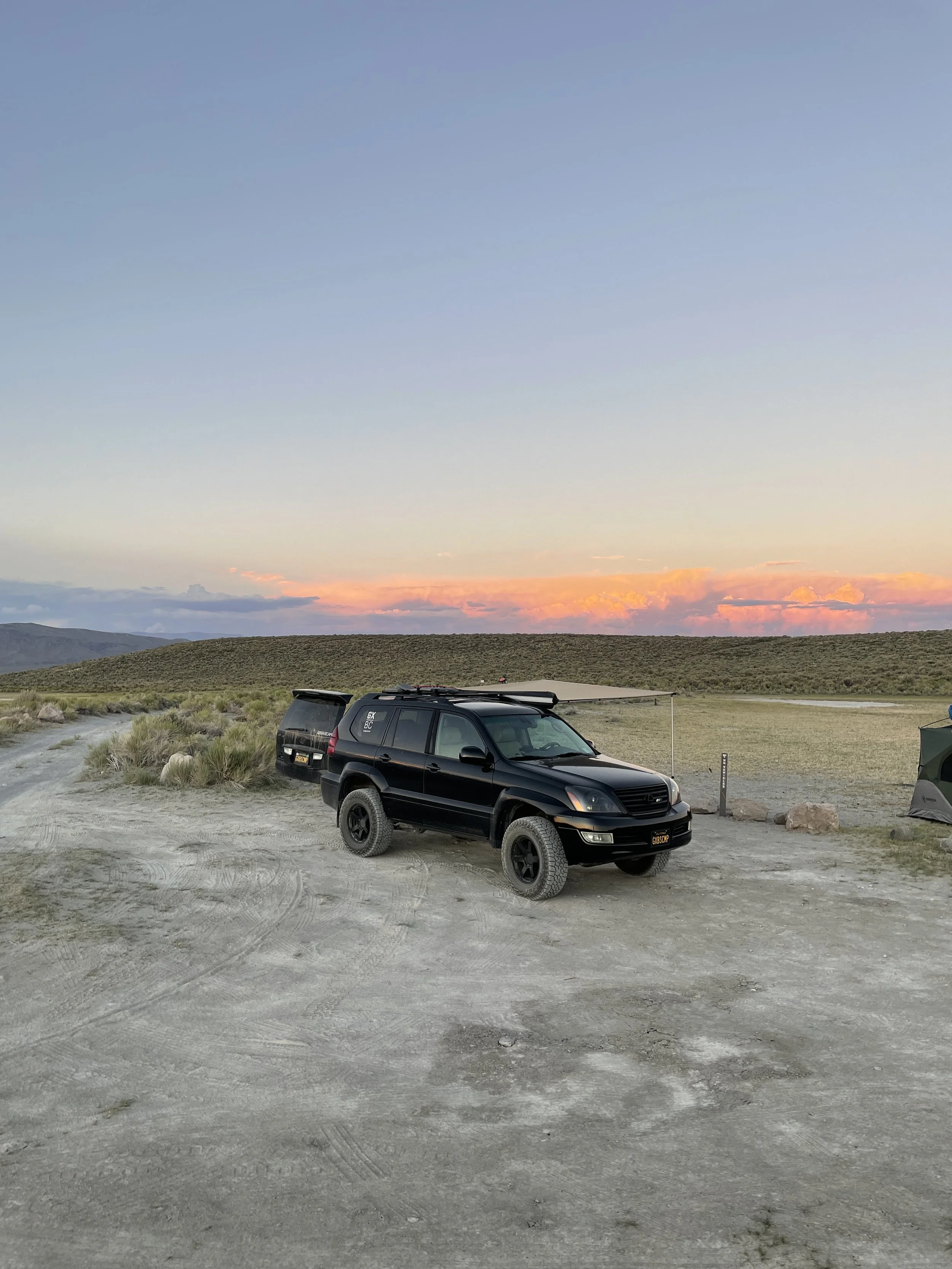
Somewhat bummed about our change of plans, we headed toward Willy’s Hot Spring off 395 to post-up for the night. This turned out to be a gorgeous campsite surrounded by mountains. We enjoyed a stunning sunset, a tasty dinner, and then crashed out for the night.

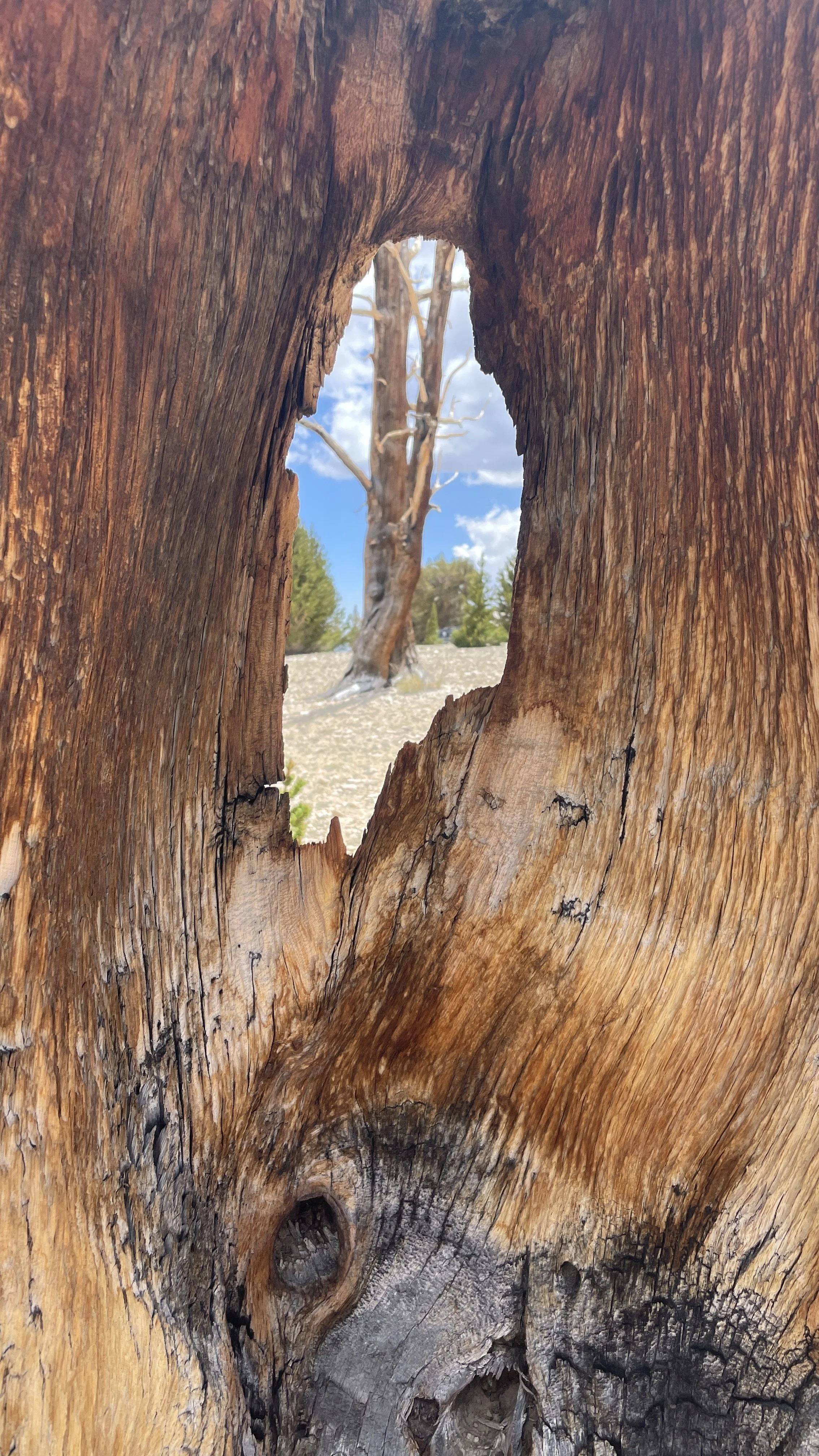
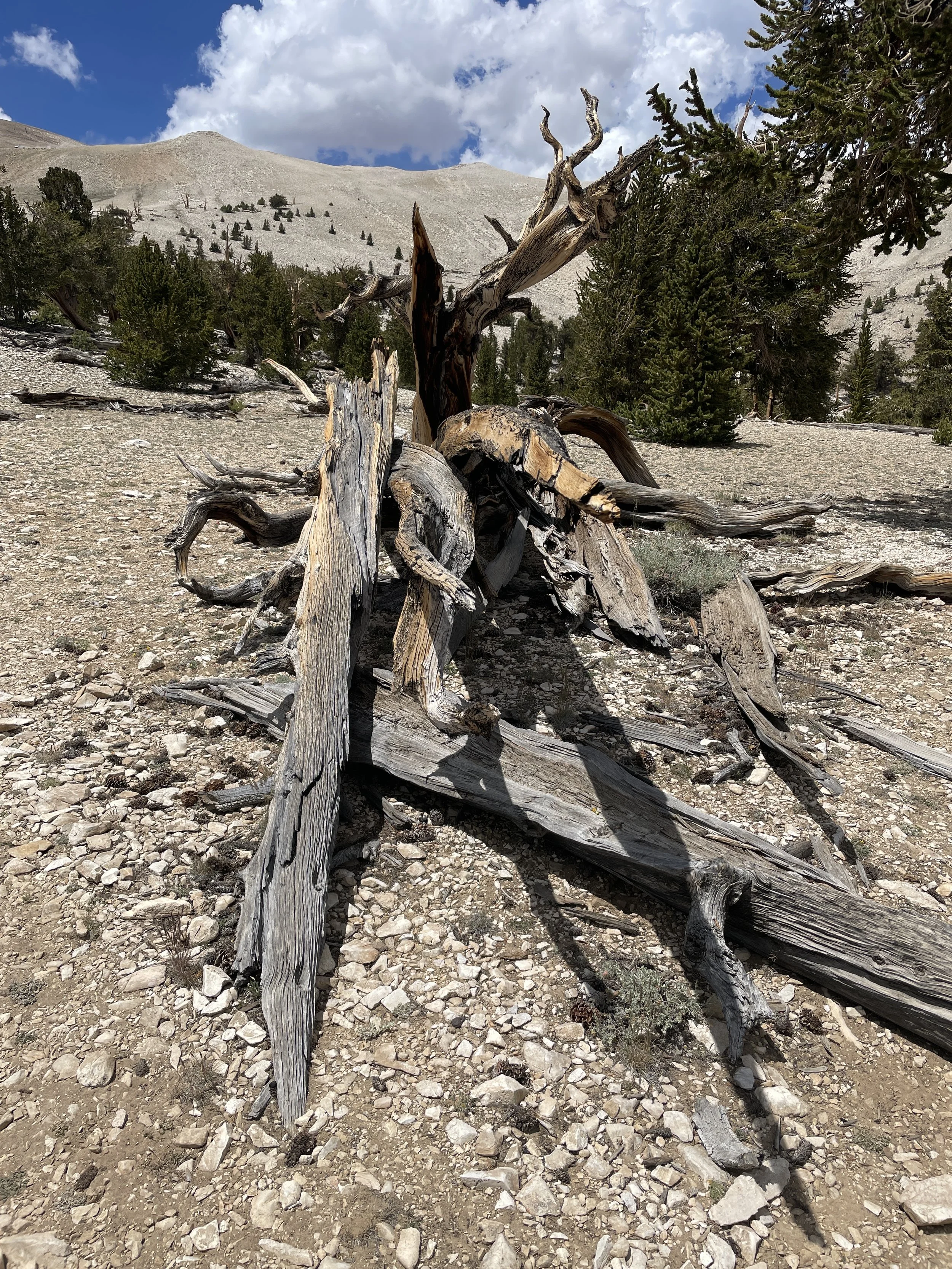
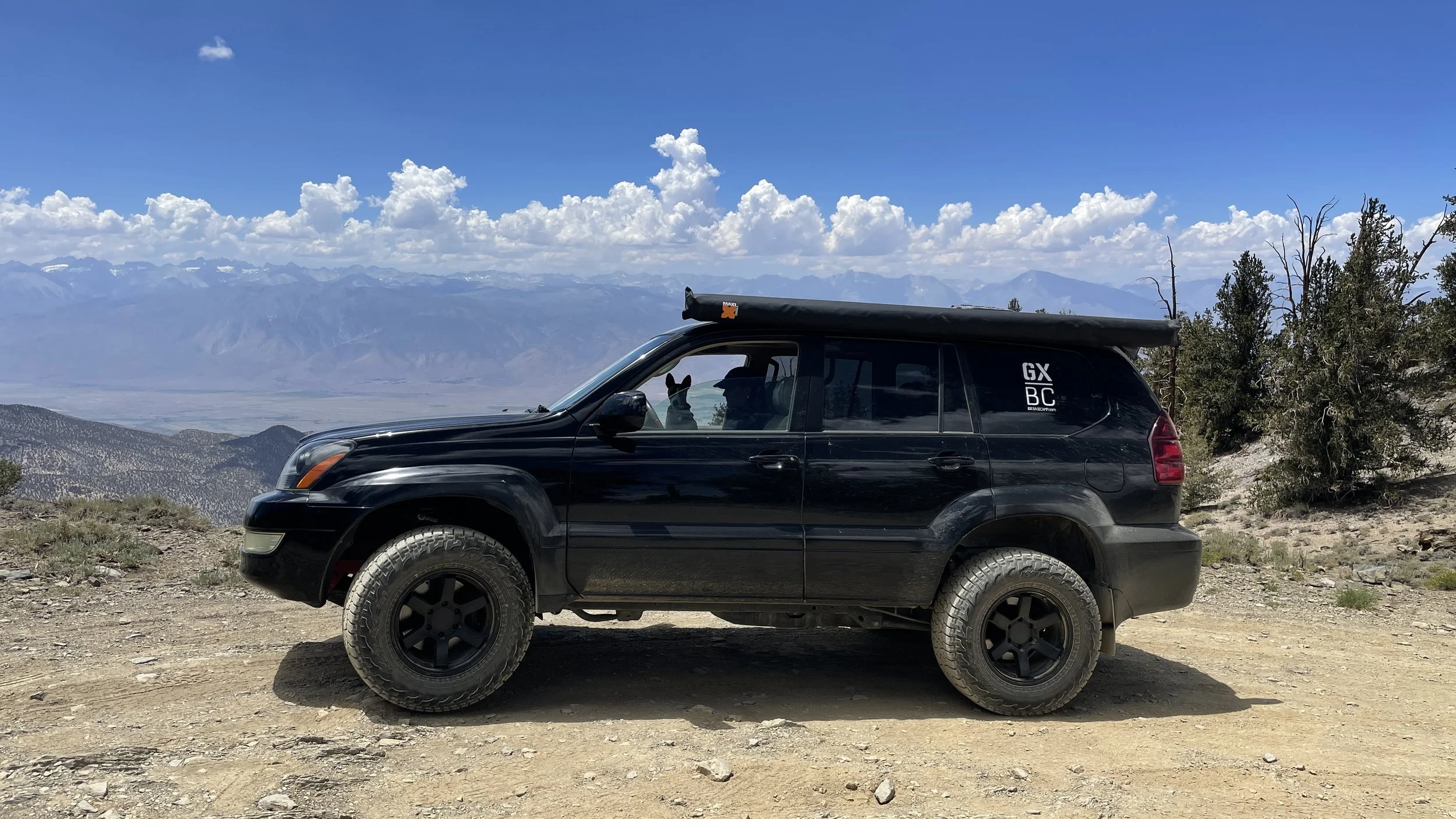
Our destination the following morning was another that we’d stopped at previously and left feeling like we wanted more time: The Ancient Bristlecone Pine Forest. Located in the Inyo National Forest above 10,000 feet, these trees are known to be thousands of years old. Further, they survive in an environment that most other wildlife can’t. Their gnarled, twisted trunks are truly unique and take thousands of years to break down, even after the tree has died. The route up to the forest is a winding, sometimes one-lane affair with unforgettable views of the Sierras across the Owens River Valley.
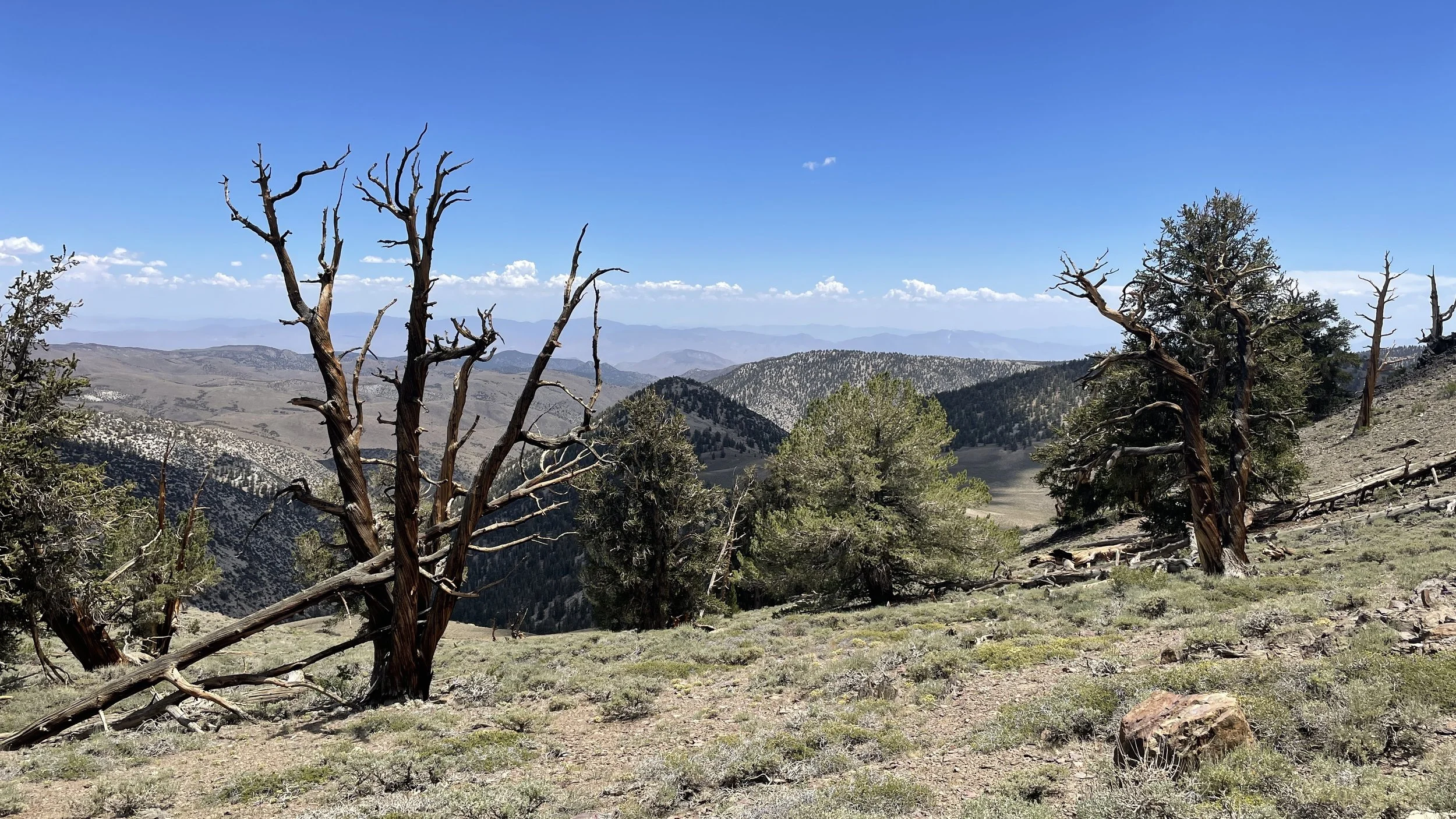
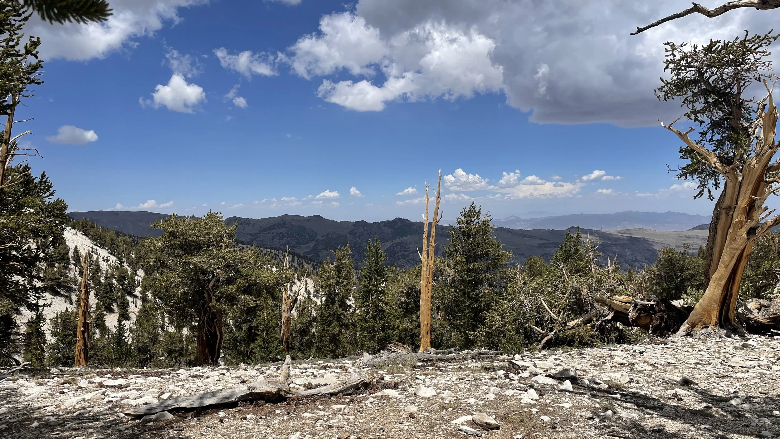
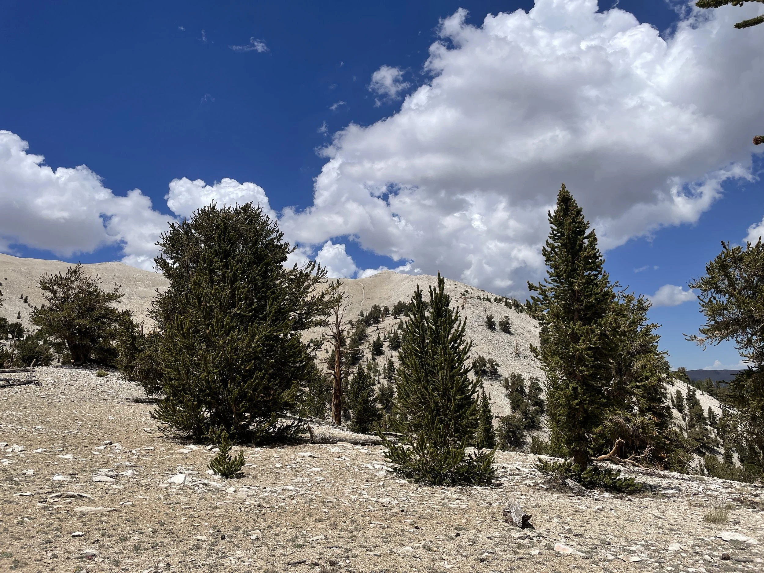

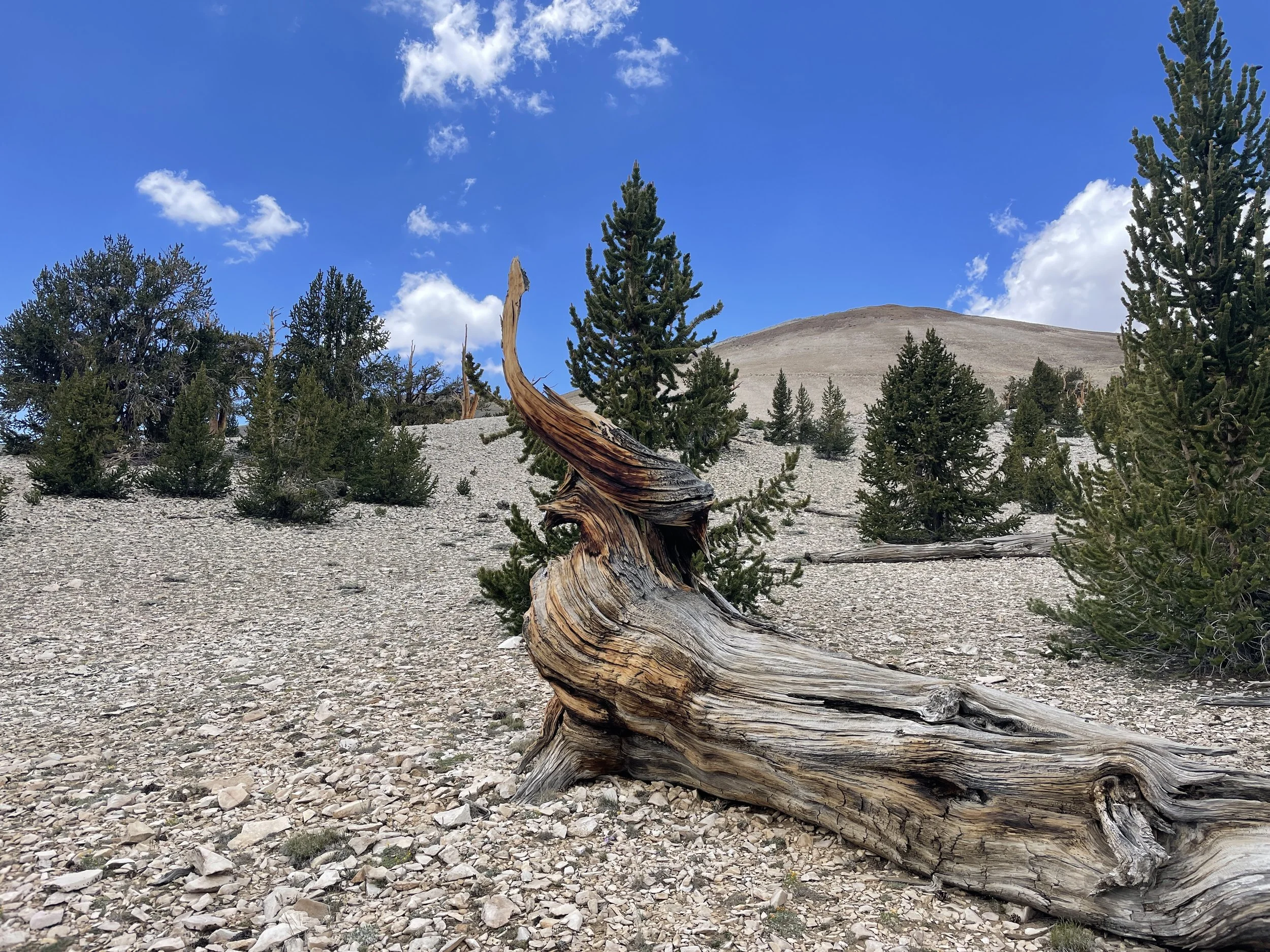
And since we never like to miss a chance to get off the beaten path, we couldn’t resist the 12 mile offroad drive from Schulman Grove out to Patriarch Grove. This adventure provides plenty of views as you wind your way through the mountains, ever upward beyond 11,200 feet in elevation.
After our visit to Patriarch Grove, we decided it was time to hit the road for the haul back to LA and the reality of a full work week ahead.